You are here: Home > Network List > II - Global Seismograph Network (GSN - IRIS/IDA) Stations List
> Station WRAB Tennant Creek, NT, Australia > Earthquake Result Viewer
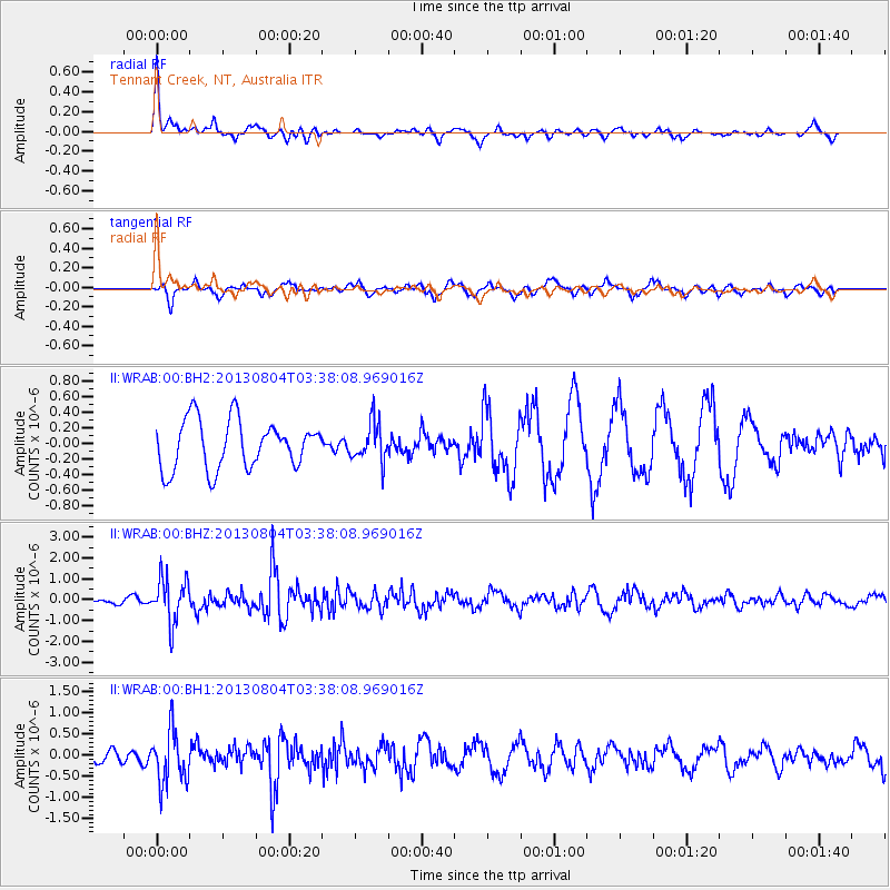
WRAB Tennant Creek, NT, Australia - Earthquake Result Viewer
*The percent match for this event was below the threshold and hence no stack was calculated.
| Earthquake location: |
Near East Coast Of Honshu, Japan |
| Earthquake latitude/longitude: |
38.2/141.9 |
| Earthquake time(UTC): |
2013/08/04 (216) 03:28:50 GMT |
| Earthquake Depth: |
56 km |
| Earthquake Magnitude: |
5.8 MW, 5.8 MB, 5.9 MW |
| Earthquake Catalog/Contributor: |
NEIC PDE/NEIC PDE-W |
|
| Network: |
II Global Seismograph Network (GSN - IRIS/IDA) |
| Station: |
WRAB Tennant Creek, NT, Australia |
| Lat/Lon: |
19.93 S/134.36 E |
| Elevation: |
366 m |
|
| Distance: |
58.3 deg |
| Az: |
188.304 deg |
| Baz: |
6.946 deg |
| Ray Param: |
$rayparam |
*The percent match for this event was below the threshold and hence was not used in the summary stack. |
|
| Radial Match: |
77.3181 % |
| Radial Bump: |
385 |
| Transverse Match: |
33.993965 % |
| Transverse Bump: |
304 |
| SOD ConfigId: |
589702 |
| Insert Time: |
2013-09-24 23:52:23.849 +0000 |
| GWidth: |
2.5 |
| Max Bumps: |
400 |
| Tol: |
0.001 |
|
Signal To Noise
| Channel | StoN | STA | LTA |
| II:WRAB:00:BHZ:20130804T03:38:08.969016Z | 7.679306 | 1.0896772E-6 | 1.4189787E-7 |
| II:WRAB:00:BH1:20130804T03:38:08.969016Z | 4.210136 | 6.2845004E-7 | 1.4927073E-7 |
| II:WRAB:00:BH2:20130804T03:38:08.969016Z | 0.77999794 | 2.4327983E-7 | 3.1189805E-7 |
| Arrivals |
| Ps | |
| PpPs | |
| PsPs/PpSs | |


