You are here: Home > Network List > IU - Global Seismograph Network (GSN - IRIS/USGS) Stations List
> Station JOHN Johnston Island, USA > Earthquake Result Viewer
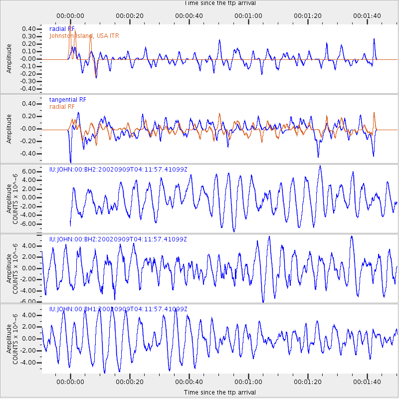
JOHN Johnston Island, USA - Earthquake Result Viewer
*The percent match for this event was below the threshold and hence no stack was calculated.
| Earthquake location: |
Ninigo Islands Region, P.N.G. |
| Earthquake latitude/longitude: |
-2.9/143.0 |
| Earthquake time(UTC): |
2002/09/09 (252) 04:03:28 GMT |
| Earthquake Depth: |
10 km |
| Earthquake Magnitude: |
5.6 MW |
| Earthquake Catalog/Contributor: |
NEIC PDE/NEIC PDE-M |
|
| Network: |
IU Global Seismograph Network (GSN - IRIS/USGS) |
| Station: |
JOHN Johnston Island, USA |
| Lat/Lon: |
16.73 N/169.53 W |
| Elevation: |
2.0 m |
|
| Distance: |
50.8 deg |
| Az: |
65.691 deg |
| Baz: |
251.781 deg |
| Ray Param: |
$rayparam |
*The percent match for this event was below the threshold and hence was not used in the summary stack. |
|
| Radial Match: |
38.4919 % |
| Radial Bump: |
400 |
| Transverse Match: |
52.190968 % |
| Transverse Bump: |
400 |
| SOD ConfigId: |
590571 |
| Insert Time: |
2013-09-24 23:53:16.874 +0000 |
| GWidth: |
2.5 |
| Max Bumps: |
400 |
| Tol: |
0.001 |
|
Signal To Noise
| Channel | StoN | STA | LTA |
| IU:JOHN:00:BHZ:20020909T04:11:57.41099Z | 1.1359892 | 2.4606109E-6 | 2.1660514E-6 |
| IU:JOHN:00:BH1:20020909T04:11:57.41099Z | 1.2014138 | 2.5851157E-6 | 2.151728E-6 |
| IU:JOHN:00:BH2:20020909T04:11:57.41099Z | 1.1620474 | 2.7250653E-6 | 2.3450552E-6 |
| Arrivals |
| Ps | |
| PpPs | |
| PsPs/PpSs | |


