You are here: Home > Network List > TA - USArray Transportable Network (new EarthScope stations) Stations List
> Station E46A Sault Ste Marie, MI, USA > Earthquake Result Viewer
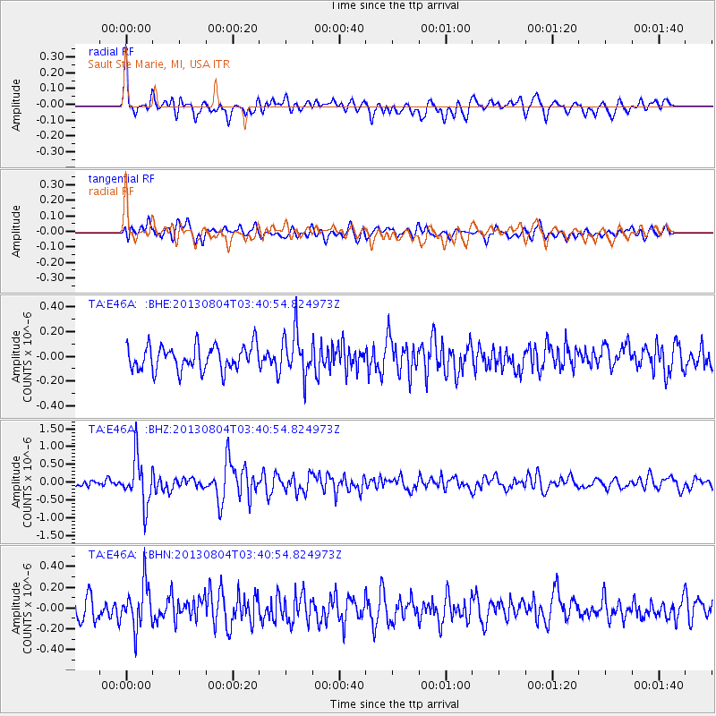
E46A Sault Ste Marie, MI, USA - Earthquake Result Viewer
*The percent match for this event was below the threshold and hence no stack was calculated.
| Earthquake location: |
Near East Coast Of Honshu, Japan |
| Earthquake latitude/longitude: |
38.2/141.9 |
| Earthquake time(UTC): |
2013/08/04 (216) 03:28:50 GMT |
| Earthquake Depth: |
56 km |
| Earthquake Magnitude: |
5.8 MW, 5.8 MB, 5.9 MW |
| Earthquake Catalog/Contributor: |
NEIC PDE/NEIC PDE-W |
|
| Network: |
TA USArray Transportable Network (new EarthScope stations) |
| Station: |
E46A Sault Ste Marie, MI, USA |
| Lat/Lon: |
46.37 N/84.31 W |
| Elevation: |
269 m |
|
| Distance: |
86.2 deg |
| Az: |
30.043 deg |
| Baz: |
325.283 deg |
| Ray Param: |
$rayparam |
*The percent match for this event was below the threshold and hence was not used in the summary stack. |
|
| Radial Match: |
74.12933 % |
| Radial Bump: |
400 |
| Transverse Match: |
54.13164 % |
| Transverse Bump: |
400 |
| SOD ConfigId: |
589702 |
| Insert Time: |
2013-09-25 00:03:36.480 +0000 |
| GWidth: |
2.5 |
| Max Bumps: |
400 |
| Tol: |
0.001 |
|
Signal To Noise
| Channel | StoN | STA | LTA |
| TA:E46A: :BHZ:20130804T03:40:54.824973Z | 7.4695854 | 6.6578934E-7 | 8.913337E-8 |
| TA:E46A: :BHN:20130804T03:40:54.824973Z | 2.534002 | 2.1168084E-7 | 8.353617E-8 |
| TA:E46A: :BHE:20130804T03:40:54.824973Z | 1.768714 | 1.7503687E-7 | 9.896279E-8 |
| Arrivals |
| Ps | |
| PpPs | |
| PsPs/PpSs | |


