You are here: Home > Network List > TA - USArray Transportable Network (new EarthScope stations) Stations List
> Station P43A Skaggs, Pawnee, IL, USA > Earthquake Result Viewer
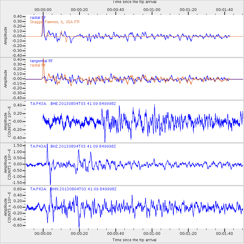
P43A Skaggs, Pawnee, IL, USA - Earthquake Result Viewer
*The percent match for this event was below the threshold and hence no stack was calculated.
| Earthquake location: |
Near East Coast Of Honshu, Japan |
| Earthquake latitude/longitude: |
38.2/141.9 |
| Earthquake time(UTC): |
2013/08/04 (216) 03:28:50 GMT |
| Earthquake Depth: |
56 km |
| Earthquake Magnitude: |
5.8 MW, 5.8 MB, 5.9 MW |
| Earthquake Catalog/Contributor: |
NEIC PDE/NEIC PDE-W |
|
| Network: |
TA USArray Transportable Network (new EarthScope stations) |
| Station: |
P43A Skaggs, Pawnee, IL, USA |
| Lat/Lon: |
39.64 N/89.52 W |
| Elevation: |
176 m |
|
| Distance: |
89.3 deg |
| Az: |
37.111 deg |
| Baz: |
322.01 deg |
| Ray Param: |
$rayparam |
*The percent match for this event was below the threshold and hence was not used in the summary stack. |
|
| Radial Match: |
70.900055 % |
| Radial Bump: |
400 |
| Transverse Match: |
57.187035 % |
| Transverse Bump: |
400 |
| SOD ConfigId: |
589702 |
| Insert Time: |
2013-09-25 00:10:08.367 +0000 |
| GWidth: |
2.5 |
| Max Bumps: |
400 |
| Tol: |
0.001 |
|
Signal To Noise
| Channel | StoN | STA | LTA |
| TA:P43A: :BHZ:20130804T03:41:09.849998Z | 6.6357665 | 5.8825105E-7 | 8.864854E-8 |
| TA:P43A: :BHN:20130804T03:41:09.849998Z | 4.4881897 | 2.341996E-7 | 5.218131E-8 |
| TA:P43A: :BHE:20130804T03:41:09.849998Z | 1.8633256 | 1.5373894E-7 | 8.2507825E-8 |
| Arrivals |
| Ps | |
| PpPs | |
| PsPs/PpSs | |


