You are here: Home > Network List > TA - USArray Transportable Network (new EarthScope stations) Stations List
> Station W49A Belvidere, TN, USA > Earthquake Result Viewer
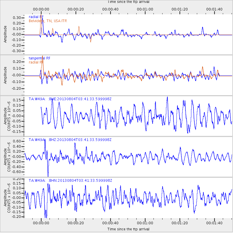
W49A Belvidere, TN, USA - Earthquake Result Viewer
*The percent match for this event was below the threshold and hence no stack was calculated.
| Earthquake location: |
Near East Coast Of Honshu, Japan |
| Earthquake latitude/longitude: |
38.2/141.9 |
| Earthquake time(UTC): |
2013/08/04 (216) 03:28:50 GMT |
| Earthquake Depth: |
56 km |
| Earthquake Magnitude: |
5.8 MW, 5.8 MB, 5.9 MW |
| Earthquake Catalog/Contributor: |
NEIC PDE/NEIC PDE-W |
|
| Network: |
TA USArray Transportable Network (new EarthScope stations) |
| Station: |
W49A Belvidere, TN, USA |
| Lat/Lon: |
35.12 N/86.26 W |
| Elevation: |
251 m |
|
| Distance: |
94.5 deg |
| Az: |
37.755 deg |
| Baz: |
323.959 deg |
| Ray Param: |
$rayparam |
*The percent match for this event was below the threshold and hence was not used in the summary stack. |
|
| Radial Match: |
58.84415 % |
| Radial Bump: |
400 |
| Transverse Match: |
48.966785 % |
| Transverse Bump: |
400 |
| SOD ConfigId: |
589702 |
| Insert Time: |
2013-09-25 00:14:07.277 +0000 |
| GWidth: |
2.5 |
| Max Bumps: |
400 |
| Tol: |
0.001 |
|
Signal To Noise
| Channel | StoN | STA | LTA |
| TA:W49A: :BHZ:20130804T03:41:33.599998Z | 2.7488618 | 2.9509354E-7 | 1.0735117E-7 |
| TA:W49A: :BHN:20130804T03:41:33.599998Z | 2.0381513 | 1.10233636E-7 | 5.408511E-8 |
| TA:W49A: :BHE:20130804T03:41:33.599998Z | 1.0945512 | 7.0033046E-8 | 6.398334E-8 |
| Arrivals |
| Ps | |
| PpPs | |
| PsPs/PpSs | |


