You are here: Home > Network List > GS - US Geological Survey Networks Stations List
> Station KAN10 Keim Farm > Earthquake Result Viewer
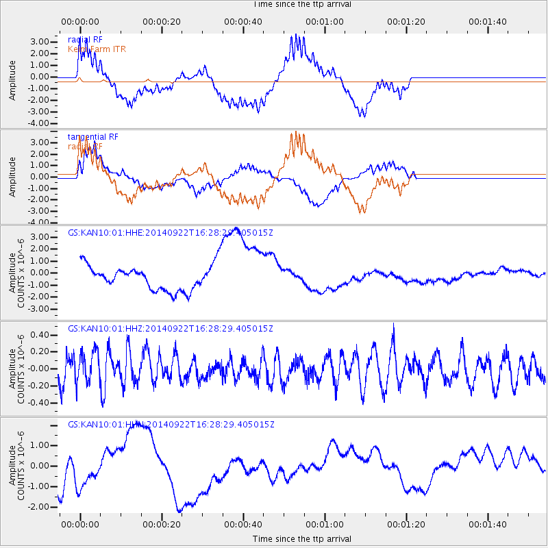
KAN10 Keim Farm - Earthquake Result Viewer
*The percent match for this event was below the threshold and hence no stack was calculated.
| Earthquake location: |
Tonga Islands |
| Earthquake latitude/longitude: |
-20.4/-174.1 |
| Earthquake time(UTC): |
2014/09/22 (265) 16:15:56 GMT |
| Earthquake Depth: |
27 km |
| Earthquake Magnitude: |
4.8 mb |
| Earthquake Catalog/Contributor: |
ISC/ISC |
|
| Network: |
GS US Geological Survey Networks |
| Station: |
KAN10 Keim Farm |
| Lat/Lon: |
37.12 N/98.10 W |
| Elevation: |
417 m |
|
| Distance: |
91.5 deg |
| Az: |
50.873 deg |
| Baz: |
245.592 deg |
| Ray Param: |
$rayparam |
*The percent match for this event was below the threshold and hence was not used in the summary stack. |
|
| Radial Match: |
52.00629 % |
| Radial Bump: |
400 |
| Transverse Match: |
45.69661 % |
| Transverse Bump: |
400 |
| SOD ConfigId: |
3390531 |
| Insert Time: |
2019-04-14 04:16:42.208 +0000 |
| GWidth: |
2.5 |
| Max Bumps: |
400 |
| Tol: |
0.001 |
|
Signal To Noise
| Channel | StoN | STA | LTA |
| GS:KAN10:01:HHZ:20140922T16:28:29.405015Z | 0.9238224 | 1.9104776E-7 | 2.0680139E-7 |
| GS:KAN10:01:HHN:20140922T16:28:29.405015Z | 1.4695936 | 1.3342435E-6 | 9.078996E-7 |
| GS:KAN10:01:HHE:20140922T16:28:29.405015Z | 1.6397424 | 1.4634039E-6 | 8.9245964E-7 |
| Arrivals |
| Ps | |
| PpPs | |
| PsPs/PpSs | |


