You are here: Home > Network List > IU - Global Seismograph Network (GSN - IRIS/USGS) Stations List
> Station JOHN Johnston Island, USA > Earthquake Result Viewer
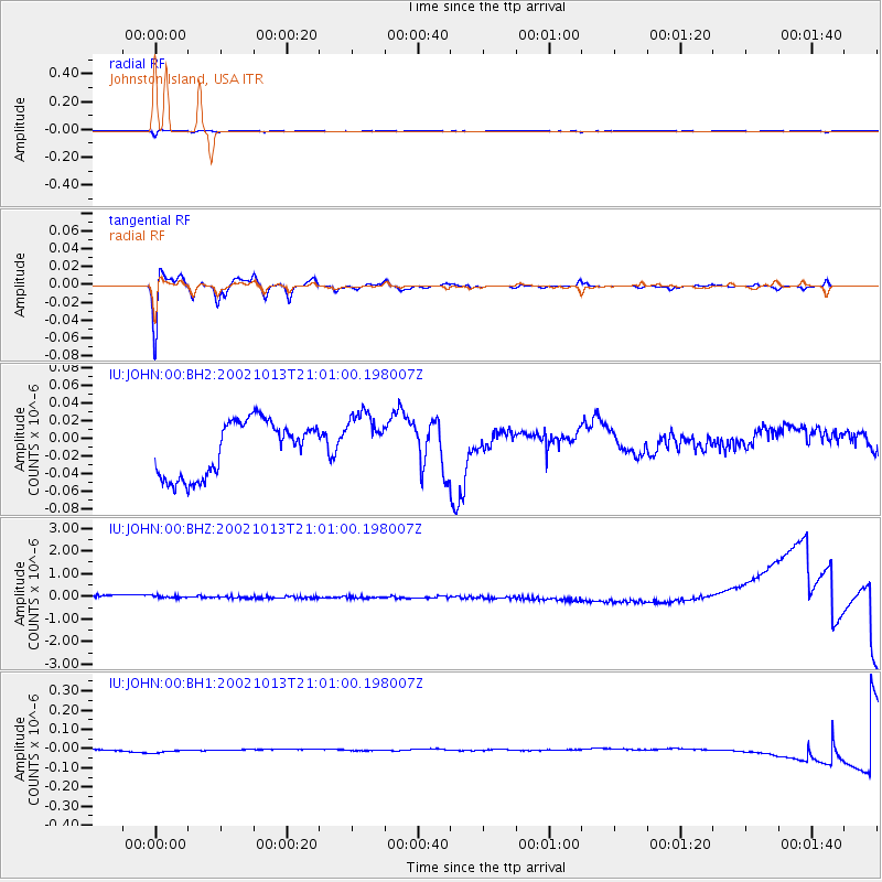
JOHN Johnston Island, USA - Earthquake Result Viewer
*The percent match for this event was below the threshold and hence no stack was calculated.
| Earthquake location: |
Samoa Islands Region |
| Earthquake latitude/longitude: |
-14.6/-175.4 |
| Earthquake time(UTC): |
2002/10/13 (286) 20:55:07 GMT |
| Earthquake Depth: |
10 km |
| Earthquake Magnitude: |
5.8 MB, 6.0 MS, 6.1 MW, 6.0 MW |
| Earthquake Catalog/Contributor: |
WHDF/NEIC |
|
| Network: |
IU Global Seismograph Network (GSN - IRIS/USGS) |
| Station: |
JOHN Johnston Island, USA |
| Lat/Lon: |
16.73 N/169.53 W |
| Elevation: |
2.0 m |
|
| Distance: |
31.7 deg |
| Az: |
10.789 deg |
| Baz: |
190.902 deg |
| Ray Param: |
$rayparam |
*The percent match for this event was below the threshold and hence was not used in the summary stack. |
|
| Radial Match: |
72.92875 % |
| Radial Bump: |
400 |
| Transverse Match: |
79.297935 % |
| Transverse Bump: |
400 |
| SOD ConfigId: |
590571 |
| Insert Time: |
2013-09-25 00:15:00.820 +0000 |
| GWidth: |
2.5 |
| Max Bumps: |
400 |
| Tol: |
0.001 |
|
Signal To Noise
| Channel | StoN | STA | LTA |
| IU:JOHN:00:BHZ:20021013T21:01:00.198007Z | 0.8850387 | 2.3462779E-7 | 2.6510457E-7 |
| IU:JOHN:00:BH1:20021013T21:01:00.198007Z | 3.961875 | 1.5928464E-8 | 4.020436E-9 |
| IU:JOHN:00:BH2:20021013T21:01:00.198007Z | 1.0584296 | 3.2465774E-8 | 3.0673533E-8 |
| Arrivals |
| Ps | |
| PpPs | |
| PsPs/PpSs | |


