You are here: Home > Network List > US - United States National Seismic Network Stations List
> Station HAWA Hanford, Washington, USA > Earthquake Result Viewer
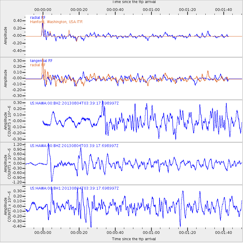
HAWA Hanford, Washington, USA - Earthquake Result Viewer
*The percent match for this event was below the threshold and hence no stack was calculated.
| Earthquake location: |
Near East Coast Of Honshu, Japan |
| Earthquake latitude/longitude: |
38.2/141.9 |
| Earthquake time(UTC): |
2013/08/04 (216) 03:28:50 GMT |
| Earthquake Depth: |
56 km |
| Earthquake Magnitude: |
5.8 MW, 5.8 MB, 5.9 MW |
| Earthquake Catalog/Contributor: |
NEIC PDE/NEIC PDE-W |
|
| Network: |
US United States National Seismic Network |
| Station: |
HAWA Hanford, Washington, USA |
| Lat/Lon: |
46.39 N/119.53 W |
| Elevation: |
364 m |
|
| Distance: |
68.7 deg |
| Az: |
47.261 deg |
| Baz: |
303.291 deg |
| Ray Param: |
$rayparam |
*The percent match for this event was below the threshold and hence was not used in the summary stack. |
|
| Radial Match: |
77.71604 % |
| Radial Bump: |
400 |
| Transverse Match: |
79.26988 % |
| Transverse Bump: |
400 |
| SOD ConfigId: |
589702 |
| Insert Time: |
2013-09-25 00:16:45.741 +0000 |
| GWidth: |
2.5 |
| Max Bumps: |
400 |
| Tol: |
0.001 |
|
Signal To Noise
| Channel | StoN | STA | LTA |
| US:HAWA:00:BHZ:20130804T03:39:17.698997Z | 10.938887 | 5.18801E-7 | 4.7427225E-8 |
| US:HAWA:00:BH1:20130804T03:39:17.698997Z | 2.0141873 | 1.17424044E-7 | 5.8298472E-8 |
| US:HAWA:00:BH2:20130804T03:39:17.698997Z | 2.5169086 | 1.4129347E-7 | 5.61377E-8 |
| Arrivals |
| Ps | |
| PpPs | |
| PsPs/PpSs | |


