You are here: Home > Network List > IU - Global Seismograph Network (GSN - IRIS/USGS) Stations List
> Station JOHN Johnston Island, USA > Earthquake Result Viewer
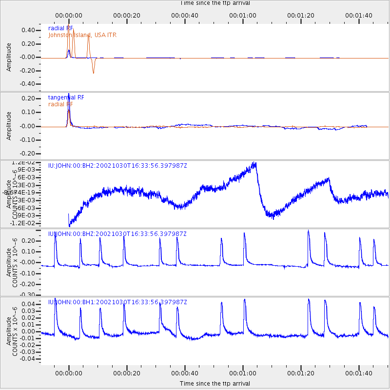
JOHN Johnston Island, USA - Earthquake Result Viewer
*The percent match for this event was below the threshold and hence no stack was calculated.
| Earthquake location: |
South Of Tonga Islands |
| Earthquake latitude/longitude: |
-25.3/-175.6 |
| Earthquake time(UTC): |
2002/10/30 (303) 16:26:34 GMT |
| Earthquake Depth: |
10 km |
| Earthquake Magnitude: |
5.6 MW, 5.6 MW, 5.8 MB |
| Earthquake Catalog/Contributor: |
NEIC PDE/NEIC PDE-M |
|
| Network: |
IU Global Seismograph Network (GSN - IRIS/USGS) |
| Station: |
JOHN Johnston Island, USA |
| Lat/Lon: |
16.73 N/169.53 W |
| Elevation: |
2.0 m |
|
| Distance: |
42.2 deg |
| Az: |
8.728 deg |
| Baz: |
188.24 deg |
| Ray Param: |
$rayparam |
*The percent match for this event was below the threshold and hence was not used in the summary stack. |
|
| Radial Match: |
85.037506 % |
| Radial Bump: |
212 |
| Transverse Match: |
83.77968 % |
| Transverse Bump: |
400 |
| SOD ConfigId: |
590571 |
| Insert Time: |
2013-09-25 00:23:12.280 +0000 |
| GWidth: |
2.5 |
| Max Bumps: |
400 |
| Tol: |
0.001 |
|
Signal To Noise
| Channel | StoN | STA | LTA |
| IU:JOHN:00:BHZ:20021030T16:33:56.397987Z | 1.0780839 | 6.286915E-8 | 5.8315642E-8 |
| IU:JOHN:00:BH1:20021030T16:33:56.397987Z | 0.98156583 | 1.126047E-8 | 1.1471946E-8 |
| IU:JOHN:00:BH2:20021030T16:33:56.397987Z | 0.34351137 | 1.4169557E-9 | 4.1249164E-9 |
| Arrivals |
| Ps | |
| PpPs | |
| PsPs/PpSs | |


