You are here: Home > Network List > IU - Global Seismograph Network (GSN - IRIS/USGS) Stations List
> Station JOHN Johnston Island, USA > Earthquake Result Viewer
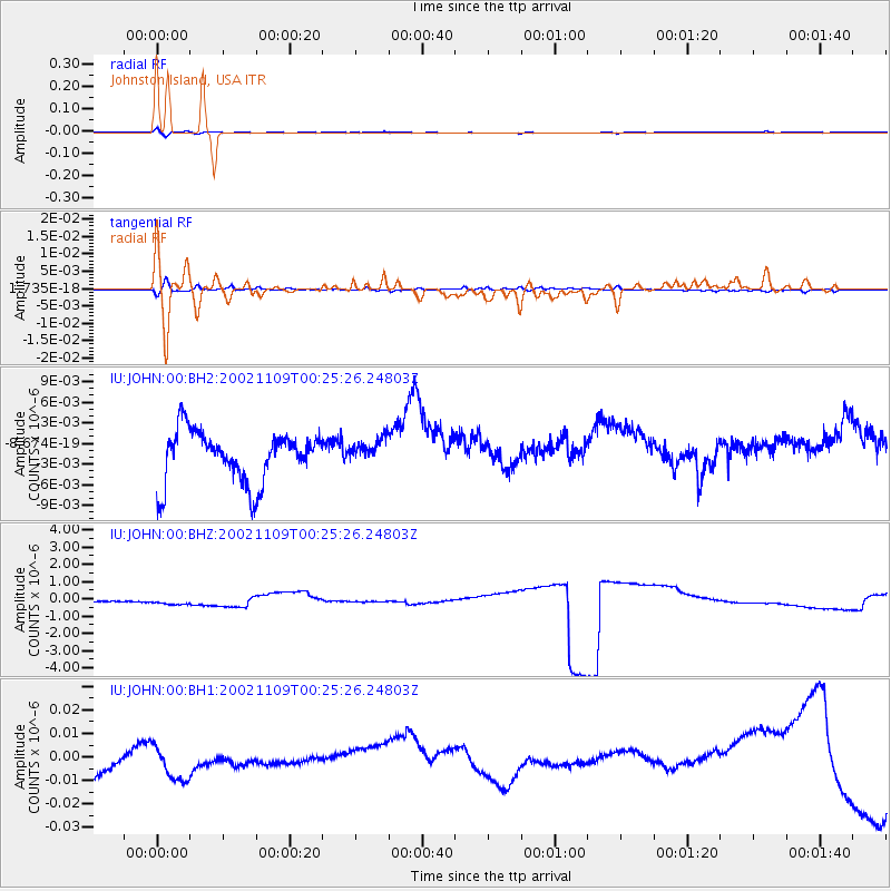
JOHN Johnston Island, USA - Earthquake Result Viewer
*The percent match for this event was below the threshold and hence no stack was calculated.
| Earthquake location: |
Near Coast Of Guatemala |
| Earthquake latitude/longitude: |
13.7/-91.2 |
| Earthquake time(UTC): |
2002/11/09 (313) 00:14:18 GMT |
| Earthquake Depth: |
33 km |
| Earthquake Magnitude: |
5.4 MB, 5.6 MS, 6.0 MW, 5.9 MW |
| Earthquake Catalog/Contributor: |
WHDF/NEIC |
|
| Network: |
IU Global Seismograph Network (GSN - IRIS/USGS) |
| Station: |
JOHN Johnston Island, USA |
| Lat/Lon: |
16.73 N/169.53 W |
| Elevation: |
2.0 m |
|
| Distance: |
75.2 deg |
| Az: |
283.906 deg |
| Baz: |
79.872 deg |
| Ray Param: |
$rayparam |
*The percent match for this event was below the threshold and hence was not used in the summary stack. |
|
| Radial Match: |
25.00333 % |
| Radial Bump: |
400 |
| Transverse Match: |
34.212025 % |
| Transverse Bump: |
393 |
| SOD ConfigId: |
590571 |
| Insert Time: |
2013-09-25 00:30:44.670 +0000 |
| GWidth: |
2.5 |
| Max Bumps: |
400 |
| Tol: |
0.001 |
|
Signal To Noise
| Channel | StoN | STA | LTA |
| IU:JOHN:00:BHZ:20021109T00:25:26.24803Z | 0.5166931 | 2.495724E-7 | 4.830186E-7 |
| IU:JOHN:00:BH1:20021109T00:25:26.24803Z | 0.17056255 | 1.1832904E-8 | 6.9375744E-8 |
| IU:JOHN:00:BH2:20021109T00:25:26.24803Z | 0.4873349 | 1.8306302E-9 | 3.756411E-9 |
| Arrivals |
| Ps | |
| PpPs | |
| PsPs/PpSs | |


