You are here: Home > Network List > IU - Global Seismograph Network (GSN - IRIS/USGS) Stations List
> Station JOHN Johnston Island, USA > Earthquake Result Viewer
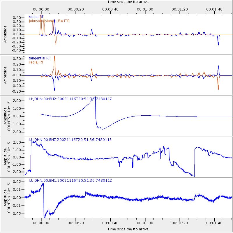
JOHN Johnston Island, USA - Earthquake Result Viewer
*The percent match for this event was below the threshold and hence no stack was calculated.
| Earthquake location: |
South Of Fiji Islands |
| Earthquake latitude/longitude: |
-26.4/178.2 |
| Earthquake time(UTC): |
2002/11/16 (320) 20:44:49 GMT |
| Earthquake Depth: |
633 km |
| Earthquake Magnitude: |
5.5 MW |
| Earthquake Catalog/Contributor: |
NEIC PDE/NEIC PDE-M |
|
| Network: |
IU Global Seismograph Network (GSN - IRIS/USGS) |
| Station: |
JOHN Johnston Island, USA |
| Lat/Lon: |
16.73 N/169.53 W |
| Elevation: |
2.0 m |
|
| Distance: |
44.5 deg |
| Az: |
16.889 deg |
| Baz: |
195.78 deg |
| Ray Param: |
$rayparam |
*The percent match for this event was below the threshold and hence was not used in the summary stack. |
|
| Radial Match: |
63.024693 % |
| Radial Bump: |
199 |
| Transverse Match: |
63.137115 % |
| Transverse Bump: |
209 |
| SOD ConfigId: |
590571 |
| Insert Time: |
2013-09-25 00:35:11.946 +0000 |
| GWidth: |
2.5 |
| Max Bumps: |
400 |
| Tol: |
0.001 |
|
Signal To Noise
| Channel | StoN | STA | LTA |
| IU:JOHN:00:BHZ:20021116T20:51:36.748011Z | 2.3081303 | 2.210531E-6 | 9.57715E-7 |
| IU:JOHN:00:BH1:20021116T20:51:36.748011Z | 5.5180335 | 1.823512E-8 | 3.304641E-9 |
| IU:JOHN:00:BH2:20021116T20:51:36.748011Z | 6.296929 | 1.7701127E-6 | 2.811073E-7 |
| Arrivals |
| Ps | |
| PpPs | |
| PsPs/PpSs | |


