You are here: Home > Network List > IU - Global Seismograph Network (GSN - IRIS/USGS) Stations List
> Station JOHN Johnston Island, USA > Earthquake Result Viewer
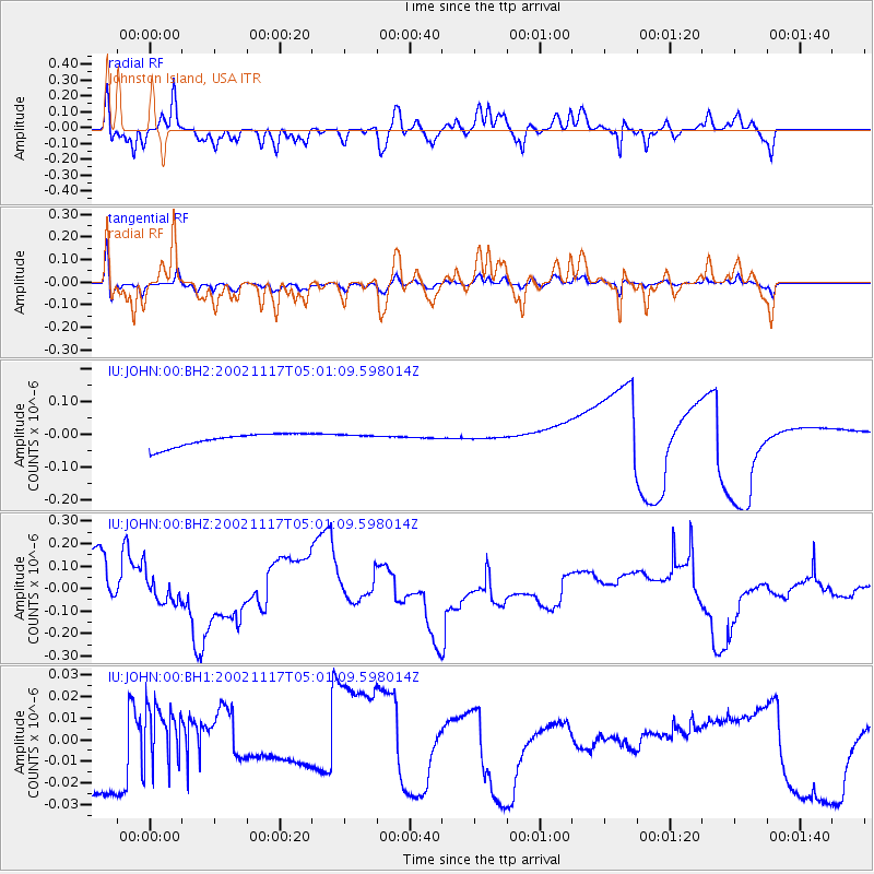
JOHN Johnston Island, USA - Earthquake Result Viewer
*The percent match for this event was below the threshold and hence no stack was calculated.
| Earthquake location: |
Northwest Of Kuril Islands |
| Earthquake latitude/longitude: |
47.8/146.2 |
| Earthquake time(UTC): |
2002/11/17 (321) 04:53:53 GMT |
| Earthquake Depth: |
459 km |
| Earthquake Magnitude: |
7.3 MW, 7.3 MW |
| Earthquake Catalog/Contributor: |
WHDF/NEIC |
|
| Network: |
IU Global Seismograph Network (GSN - IRIS/USGS) |
| Station: |
JOHN Johnston Island, USA |
| Lat/Lon: |
16.73 N/169.53 W |
| Elevation: |
2.0 m |
|
| Distance: |
47.6 deg |
| Az: |
115.164 deg |
| Baz: |
320.465 deg |
| Ray Param: |
$rayparam |
*The percent match for this event was below the threshold and hence was not used in the summary stack. |
|
| Radial Match: |
62.072575 % |
| Radial Bump: |
358 |
| Transverse Match: |
56.10081 % |
| Transverse Bump: |
400 |
| SOD ConfigId: |
590571 |
| Insert Time: |
2013-09-25 00:35:58.766 +0000 |
| GWidth: |
2.5 |
| Max Bumps: |
400 |
| Tol: |
0.001 |
|
Signal To Noise
| Channel | StoN | STA | LTA |
| IU:JOHN:00:BHZ:20021117T05:01:09.598014Z | 0.7155466 | 5.988339E-8 | 8.368902E-8 |
| IU:JOHN:00:BH1:20021117T05:01:09.598014Z | 0.96526754 | 1.521053E-8 | 1.5757838E-8 |
| IU:JOHN:00:BH2:20021117T05:01:09.598014Z | 0.5116876 | 4.10078E-9 | 8.014226E-9 |
| Arrivals |
| Ps | |
| PpPs | |
| PsPs/PpSs | |


