You are here: Home > Network List > TA - USArray Transportable Network (new EarthScope stations) Stations List
> Station M49A Liberty Center, OH, USA > Earthquake Result Viewer
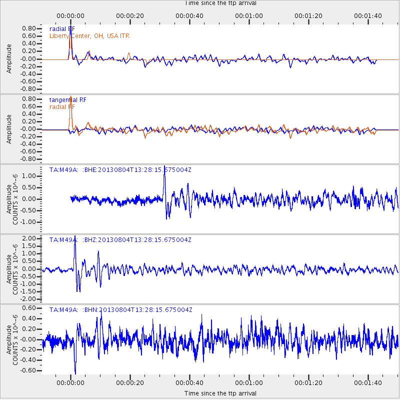
M49A Liberty Center, OH, USA - Earthquake Result Viewer
*The percent match for this event was below the threshold and hence no stack was calculated.
| Earthquake location: |
Vancouver Island, Canada Region |
| Earthquake latitude/longitude: |
49.7/-127.4 |
| Earthquake time(UTC): |
2013/08/04 (216) 13:22:27 GMT |
| Earthquake Depth: |
10 km |
| Earthquake Magnitude: |
5.6 MB, 5.5 MW |
| Earthquake Catalog/Contributor: |
NEIC PDE/NEIC PDE-W |
|
| Network: |
TA USArray Transportable Network (new EarthScope stations) |
| Station: |
M49A Liberty Center, OH, USA |
| Lat/Lon: |
41.47 N/83.98 W |
| Elevation: |
203 m |
|
| Distance: |
31.1 deg |
| Az: |
88.434 deg |
| Baz: |
300.181 deg |
| Ray Param: |
$rayparam |
*The percent match for this event was below the threshold and hence was not used in the summary stack. |
|
| Radial Match: |
77.69208 % |
| Radial Bump: |
400 |
| Transverse Match: |
54.475967 % |
| Transverse Bump: |
400 |
| SOD ConfigId: |
589702 |
| Insert Time: |
2013-09-25 00:36:48.833 +0000 |
| GWidth: |
2.5 |
| Max Bumps: |
400 |
| Tol: |
0.001 |
|
Signal To Noise
| Channel | StoN | STA | LTA |
| TA:M49A: :BHZ:20130804T13:28:15.675004Z | 11.127059 | 7.814617E-7 | 7.0230755E-8 |
| TA:M49A: :BHN:20130804T13:28:15.675004Z | 2.8801496 | 2.1095828E-7 | 7.32456E-8 |
| TA:M49A: :BHE:20130804T13:28:15.675004Z | 4.6330714 | 4.63758E-7 | 1.0009731E-7 |
| Arrivals |
| Ps | |
| PpPs | |
| PsPs/PpSs | |


