You are here: Home > Network List > TA - USArray Transportable Network (new EarthScope stations) Stations List
> Station Q50A Georgetown, OH, USA > Earthquake Result Viewer
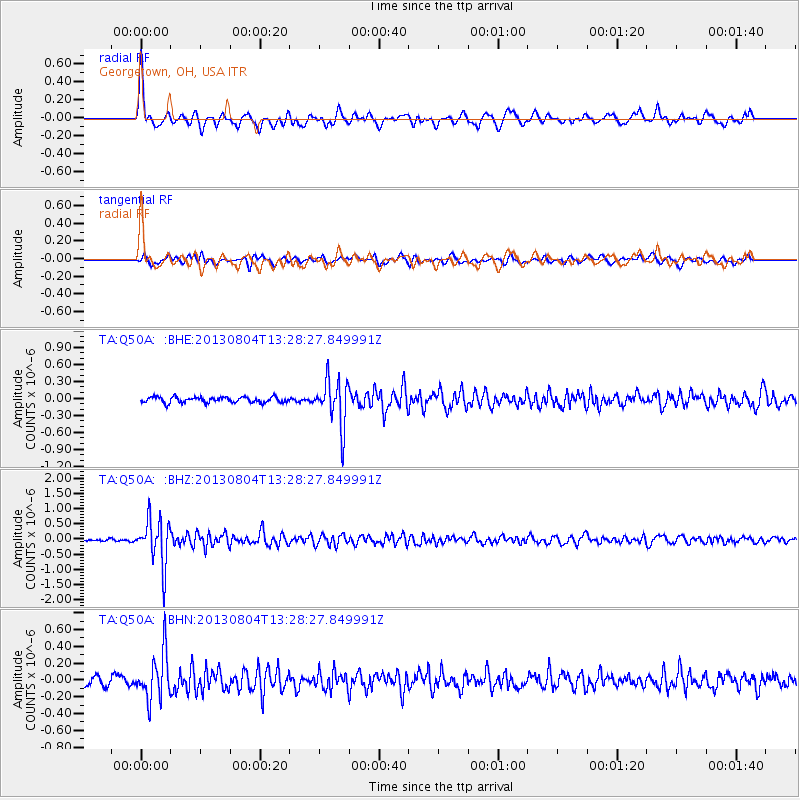
Q50A Georgetown, OH, USA - Earthquake Result Viewer
*The percent match for this event was below the threshold and hence no stack was calculated.
| Earthquake location: |
Vancouver Island, Canada Region |
| Earthquake latitude/longitude: |
49.7/-127.4 |
| Earthquake time(UTC): |
2013/08/04 (216) 13:22:27 GMT |
| Earthquake Depth: |
10 km |
| Earthquake Magnitude: |
5.6 MB, 5.5 MW |
| Earthquake Catalog/Contributor: |
NEIC PDE/NEIC PDE-W |
|
| Network: |
TA USArray Transportable Network (new EarthScope stations) |
| Station: |
Q50A Georgetown, OH, USA |
| Lat/Lon: |
38.84 N/83.98 W |
| Elevation: |
262 m |
|
| Distance: |
32.5 deg |
| Az: |
92.665 deg |
| Baz: |
303.773 deg |
| Ray Param: |
$rayparam |
*The percent match for this event was below the threshold and hence was not used in the summary stack. |
|
| Radial Match: |
79.615875 % |
| Radial Bump: |
400 |
| Transverse Match: |
59.5623 % |
| Transverse Bump: |
400 |
| SOD ConfigId: |
589702 |
| Insert Time: |
2013-09-25 00:38:58.768 +0000 |
| GWidth: |
2.5 |
| Max Bumps: |
400 |
| Tol: |
0.001 |
|
Signal To Noise
| Channel | StoN | STA | LTA |
| TA:Q50A: :BHZ:20130804T13:28:27.849991Z | 13.685669 | 7.5334054E-7 | 5.504594E-8 |
| TA:Q50A: :BHN:20130804T13:28:27.849991Z | 4.5980325 | 2.7907942E-7 | 6.06954E-8 |
| TA:Q50A: :BHE:20130804T13:28:27.849991Z | 8.31024 | 4.0989696E-7 | 4.932432E-8 |
| Arrivals |
| Ps | |
| PpPs | |
| PsPs/PpSs | |


