You are here: Home > Network List > TA - USArray Transportable Network (new EarthScope stations) Stations List
> Station Q53A Leroy, WV, USA > Earthquake Result Viewer
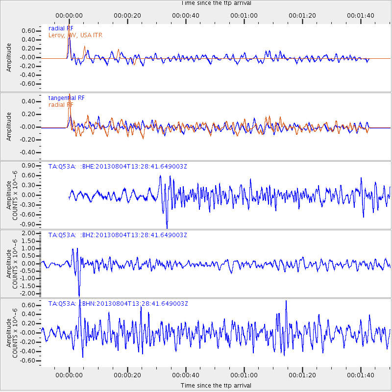
Q53A Leroy, WV, USA - Earthquake Result Viewer
*The percent match for this event was below the threshold and hence no stack was calculated.
| Earthquake location: |
Vancouver Island, Canada Region |
| Earthquake latitude/longitude: |
49.7/-127.4 |
| Earthquake time(UTC): |
2013/08/04 (216) 13:22:27 GMT |
| Earthquake Depth: |
10 km |
| Earthquake Magnitude: |
5.6 MB, 5.5 MW |
| Earthquake Catalog/Contributor: |
NEIC PDE/NEIC PDE-W |
|
| Network: |
TA USArray Transportable Network (new EarthScope stations) |
| Station: |
Q53A Leroy, WV, USA |
| Lat/Lon: |
38.86 N/81.53 W |
| Elevation: |
310 m |
|
| Distance: |
34.1 deg |
| Az: |
90.705 deg |
| Baz: |
303.669 deg |
| Ray Param: |
$rayparam |
*The percent match for this event was below the threshold and hence was not used in the summary stack. |
|
| Radial Match: |
61.98089 % |
| Radial Bump: |
400 |
| Transverse Match: |
63.147095 % |
| Transverse Bump: |
400 |
| SOD ConfigId: |
589702 |
| Insert Time: |
2013-09-25 00:39:08.700 +0000 |
| GWidth: |
2.5 |
| Max Bumps: |
400 |
| Tol: |
0.001 |
|
Signal To Noise
| Channel | StoN | STA | LTA |
| TA:Q53A: :BHZ:20130804T13:28:41.649003Z | 5.3941555 | 7.3304955E-7 | 1.35897E-7 |
| TA:Q53A: :BHN:20130804T13:28:41.649003Z | 3.2120993 | 2.577632E-7 | 8.024758E-8 |
| TA:Q53A: :BHE:20130804T13:28:41.649003Z | 4.1870084 | 4.0358222E-7 | 9.638916E-8 |
| Arrivals |
| Ps | |
| PpPs | |
| PsPs/PpSs | |


