You are here: Home > Network List > TA - USArray Transportable Network (new EarthScope stations) Stations List
> Station Q58A Fox Den Farm, The Plains, VA, USA > Earthquake Result Viewer
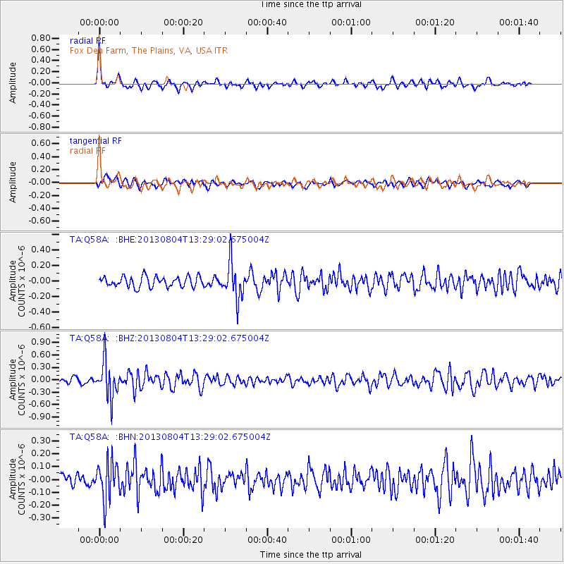
Q58A Fox Den Farm, The Plains, VA, USA - Earthquake Result Viewer
*The percent match for this event was below the threshold and hence no stack was calculated.
| Earthquake location: |
Vancouver Island, Canada Region |
| Earthquake latitude/longitude: |
49.7/-127.4 |
| Earthquake time(UTC): |
2013/08/04 (216) 13:22:27 GMT |
| Earthquake Depth: |
10 km |
| Earthquake Magnitude: |
5.6 MB, 5.5 MW |
| Earthquake Catalog/Contributor: |
NEIC PDE/NEIC PDE-W |
|
| Network: |
TA USArray Transportable Network (new EarthScope stations) |
| Station: |
Q58A Fox Den Farm, The Plains, VA, USA |
| Lat/Lon: |
38.94 N/77.68 W |
| Elevation: |
182 m |
|
| Distance: |
36.6 deg |
| Az: |
87.714 deg |
| Baz: |
303.631 deg |
| Ray Param: |
$rayparam |
*The percent match for this event was below the threshold and hence was not used in the summary stack. |
|
| Radial Match: |
79.68697 % |
| Radial Bump: |
393 |
| Transverse Match: |
60.171833 % |
| Transverse Bump: |
400 |
| SOD ConfigId: |
589702 |
| Insert Time: |
2013-09-25 00:39:18.461 +0000 |
| GWidth: |
2.5 |
| Max Bumps: |
400 |
| Tol: |
0.001 |
|
Signal To Noise
| Channel | StoN | STA | LTA |
| TA:Q58A: :BHZ:20130804T13:29:02.675004Z | 6.103534 | 4.3790968E-7 | 7.174691E-8 |
| TA:Q58A: :BHN:20130804T13:29:02.675004Z | 3.206898 | 1.4903506E-7 | 4.647328E-8 |
| TA:Q58A: :BHE:20130804T13:29:02.675004Z | 3.5362735 | 2.3697064E-7 | 6.7011406E-8 |
| Arrivals |
| Ps | |
| PpPs | |
| PsPs/PpSs | |


