You are here: Home > Network List > IU - Global Seismograph Network (GSN - IRIS/USGS) Stations List
> Station POHA Pohakuloa, Hawaii, USA > Earthquake Result Viewer
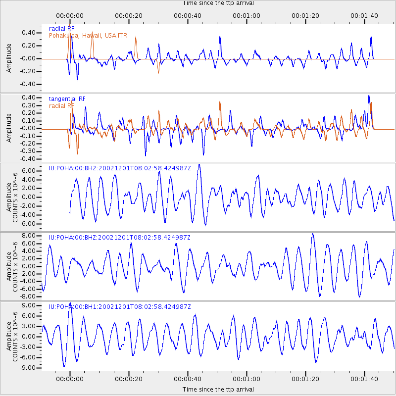
POHA Pohakuloa, Hawaii, USA - Earthquake Result Viewer
*The percent match for this event was below the threshold and hence no stack was calculated.
| Earthquake location: |
Samoa Islands Region |
| Earthquake latitude/longitude: |
-16.1/-173.0 |
| Earthquake time(UTC): |
2002/12/01 (335) 07:56:01 GMT |
| Earthquake Depth: |
33 km |
| Earthquake Magnitude: |
5.3 MB, 5.5 MS, 6.0 MW, 5.9 MW |
| Earthquake Catalog/Contributor: |
WHDF/NEIC |
|
| Network: |
IU Global Seismograph Network (GSN - IRIS/USGS) |
| Station: |
POHA Pohakuloa, Hawaii, USA |
| Lat/Lon: |
19.76 N/155.53 W |
| Elevation: |
1967 m |
|
| Distance: |
39.5 deg |
| Az: |
26.319 deg |
| Baz: |
206.908 deg |
| Ray Param: |
$rayparam |
*The percent match for this event was below the threshold and hence was not used in the summary stack. |
|
| Radial Match: |
55.334152 % |
| Radial Bump: |
400 |
| Transverse Match: |
52.074593 % |
| Transverse Bump: |
381 |
| SOD ConfigId: |
590571 |
| Insert Time: |
2013-09-25 00:40:08.705 +0000 |
| GWidth: |
2.5 |
| Max Bumps: |
400 |
| Tol: |
0.001 |
|
Signal To Noise
| Channel | StoN | STA | LTA |
| IU:POHA:00:BHZ:20021201T08:02:58.424987Z | 0.5801879 | 1.7186592E-6 | 2.9622458E-6 |
| IU:POHA:00:BH1:20021201T08:02:58.424987Z | 2.085053 | 5.6429526E-6 | 2.7063834E-6 |
| IU:POHA:00:BH2:20021201T08:02:58.424987Z | 1.2456781 | 3.633649E-6 | 2.9170048E-6 |
| Arrivals |
| Ps | |
| PpPs | |
| PsPs/PpSs | |


