You are here: Home > Network List > KN - Kyrgyz Seismic Telemetry Network Stations List
> Station TKM2 - > Earthquake Result Viewer
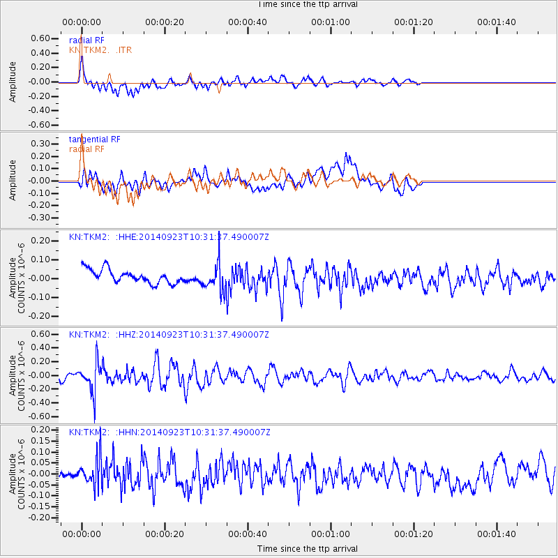
TKM2 - - Earthquake Result Viewer
*The percent match for this event was below the threshold and hence no stack was calculated.
| Earthquake location: |
Minahassa Peninsula, Sulawesi |
| Earthquake latitude/longitude: |
0.1/120.1 |
| Earthquake time(UTC): |
2014/09/23 (266) 10:22:19 GMT |
| Earthquake Depth: |
61 km |
| Earthquake Magnitude: |
5.3 MW |
| Earthquake Catalog/Contributor: |
ISC/ISC |
|
| Network: |
KN Kyrgyz Seismic Telemetry Network |
| Station: |
TKM2 - |
| Lat/Lon: |
42.92 N/75.60 E |
| Elevation: |
2020 m |
|
| Distance: |
58.3 deg |
| Az: |
322.781 deg |
| Baz: |
124.571 deg |
| Ray Param: |
$rayparam |
*The percent match for this event was below the threshold and hence was not used in the summary stack. |
|
| Radial Match: |
64.85153 % |
| Radial Bump: |
400 |
| Transverse Match: |
61.346466 % |
| Transverse Bump: |
400 |
| SOD ConfigId: |
3390531 |
| Insert Time: |
2019-04-14 04:33:34.801 +0000 |
| GWidth: |
2.5 |
| Max Bumps: |
400 |
| Tol: |
0.001 |
|
Signal To Noise
| Channel | StoN | STA | LTA |
| KN:TKM2: :HHZ:20140923T10:31:37.490007Z | 4.250623 | 2.1494397E-7 | 5.0567635E-8 |
| KN:TKM2: :HHN:20140923T10:31:37.490007Z | 2.2990124 | 7.220204E-8 | 3.1405676E-8 |
| KN:TKM2: :HHE:20140923T10:31:37.490007Z | 2.0144594 | 7.1891996E-8 | 3.5687982E-8 |
| Arrivals |
| Ps | |
| PpPs | |
| PsPs/PpSs | |


