You are here: Home > Network List > TJ - Tajikistan National Seismic Network Stations List
> Station GARM Garm, Tajikistan > Earthquake Result Viewer
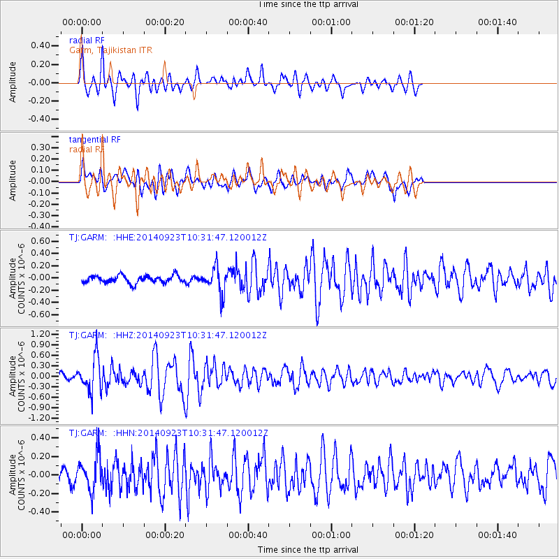
GARM Garm, Tajikistan - Earthquake Result Viewer
*The percent match for this event was below the threshold and hence no stack was calculated.
| Earthquake location: |
Minahassa Peninsula, Sulawesi |
| Earthquake latitude/longitude: |
0.1/120.1 |
| Earthquake time(UTC): |
2014/09/23 (266) 10:22:19 GMT |
| Earthquake Depth: |
61 km |
| Earthquake Magnitude: |
5.3 MW |
| Earthquake Catalog/Contributor: |
ISC/ISC |
|
| Network: |
TJ Tajikistan National Seismic Network |
| Station: |
GARM Garm, Tajikistan |
| Lat/Lon: |
39.00 N/70.32 E |
| Elevation: |
1305 m |
|
| Distance: |
59.7 deg |
| Az: |
316.457 deg |
| Baz: |
117.86 deg |
| Ray Param: |
$rayparam |
*The percent match for this event was below the threshold and hence was not used in the summary stack. |
|
| Radial Match: |
85.89255 % |
| Radial Bump: |
400 |
| Transverse Match: |
74.14026 % |
| Transverse Bump: |
400 |
| SOD ConfigId: |
3390531 |
| Insert Time: |
2019-04-14 04:34:17.923 +0000 |
| GWidth: |
2.5 |
| Max Bumps: |
400 |
| Tol: |
0.001 |
|
Signal To Noise
| Channel | StoN | STA | LTA |
| TJ:GARM: :HHZ:20140923T10:31:47.120012Z | 6.2580047 | 5.064631E-7 | 8.093044E-8 |
| TJ:GARM: :HHN:20140923T10:31:47.120012Z | 2.1918125 | 1.967089E-7 | 8.974714E-8 |
| TJ:GARM: :HHE:20140923T10:31:47.120012Z | 3.6953526 | 2.24145E-7 | 6.0655914E-8 |
| Arrivals |
| Ps | |
| PpPs | |
| PsPs/PpSs | |


