You are here: Home > Network List > IU - Global Seismograph Network (GSN - IRIS/USGS) Stations List
> Station JOHN Johnston Island, USA > Earthquake Result Viewer
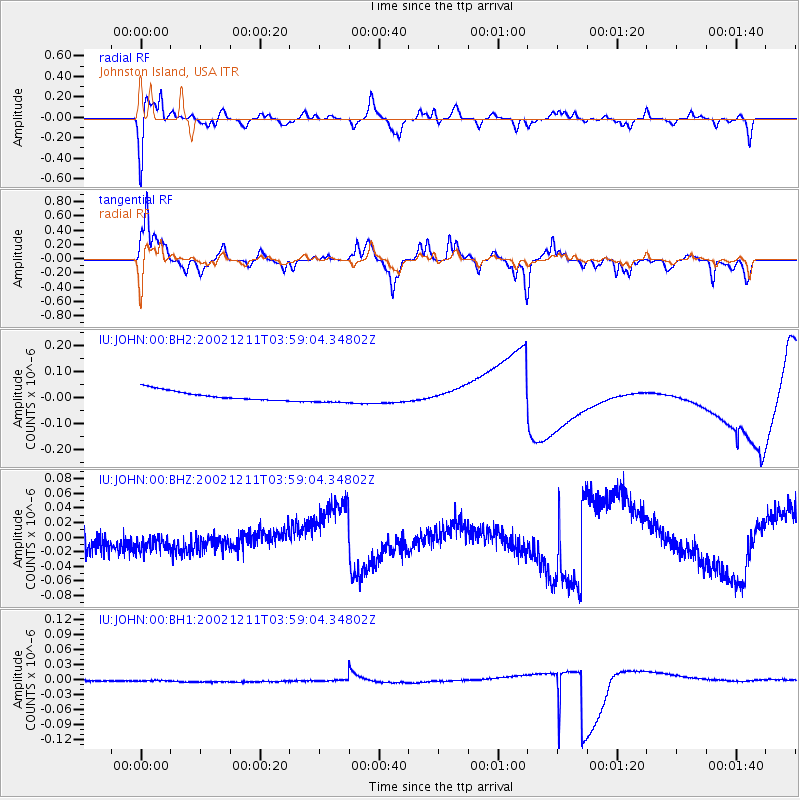
JOHN Johnston Island, USA - Earthquake Result Viewer
*The percent match for this event was below the threshold and hence no stack was calculated.
| Earthquake location: |
Irian Jaya Region, Indonesia |
| Earthquake latitude/longitude: |
-3.8/135.1 |
| Earthquake time(UTC): |
2002/12/11 (345) 03:49:40 GMT |
| Earthquake Depth: |
10 km |
| Earthquake Magnitude: |
5.8 MB, 6.0 MS, 6.3 MW, 6.3 MW |
| Earthquake Catalog/Contributor: |
WHDF/NEIC |
|
| Network: |
IU Global Seismograph Network (GSN - IRIS/USGS) |
| Station: |
JOHN Johnston Island, USA |
| Lat/Lon: |
16.73 N/169.53 W |
| Elevation: |
2.0 m |
|
| Distance: |
58.3 deg |
| Az: |
67.812 deg |
| Baz: |
254.633 deg |
| Ray Param: |
$rayparam |
*The percent match for this event was below the threshold and hence was not used in the summary stack. |
|
| Radial Match: |
68.97102 % |
| Radial Bump: |
400 |
| Transverse Match: |
62.964027 % |
| Transverse Bump: |
311 |
| SOD ConfigId: |
590571 |
| Insert Time: |
2013-09-25 00:44:23.615 +0000 |
| GWidth: |
2.5 |
| Max Bumps: |
400 |
| Tol: |
0.001 |
|
Signal To Noise
| Channel | StoN | STA | LTA |
| IU:JOHN:00:BHZ:20021211T03:59:04.34802Z | 1.221498 | 3.7837403E-8 | 3.0976228E-8 |
| IU:JOHN:00:BH1:20021211T03:59:04.34802Z | 1.1602095 | 1.0927526E-9 | 9.418579E-10 |
| IU:JOHN:00:BH2:20021211T03:59:04.34802Z | 1.4659394 | 2.6659327E-8 | 1.8185832E-8 |
| Arrivals |
| Ps | |
| PpPs | |
| PsPs/PpSs | |


