ULM LAC DU BONNET, MB, CANADA - Earthquake Result Viewer
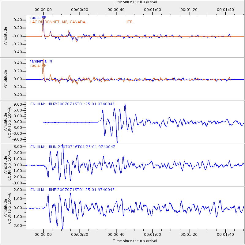
Earthquake location: Near West Coast Of Honshu, Japan
Earthquake latitude/longitude: 37.5/138.4
Earthquake time(UTC): 2007/07/16 (197) 01:13:22 GMT
Earthquake Depth: 12 km
Earthquake Magnitude: 6.5 MB, 6.4 MS, 6.6 MW, 6.5 MW
Earthquake Catalog/Contributor: WHDF/NEIC
Network: CN Canadian National Seismograph Network
Station: ULM LAC DU BONNET, MB, CANADA
Lat/Lon: 50.25 N/95.87 W
Elevation: 251 m
Distance: 80.4 deg
Az: 31.934 deg
Baz: 319.081 deg
Ray Param: 0.04832785
Estimated Moho Depth: 35.25 km
Estimated Crust Vp/Vs: 1.74
Assumed Crust Vp: 6.459 km/s
Estimated Crust Vs: 3.712 km/s
Estimated Crust Poisson's Ratio: 0.25
Radial Match: 97.93269 %
Radial Bump: 322
Transverse Match: 91.24774 %
Transverse Bump: 400
SOD ConfigId: 2564
Insert Time: 2010-02-27 07:32:49.243 +0000
GWidth: 2.5
Max Bumps: 400
Tol: 0.001

Signal To Noise

ChannelStoNSTALTA
CN:ULM: :BHN:20070716T01:25:01.974004Z13.7873511.0144306E-67.3576906E-8
CN:ULM: :BHE:20070716T01:25:01.974004Z16.3476147.2164636E-74.414383E-8
CN:ULM: :BHZ:20070716T01:25:01.974004Z41.6930163.1008778E-67.4374036E-8
Arrivals
Ps4.2 SECOND
PpPs15 SECOND
PsPs/PpSs19 SECOND