
ULM LAC DU BONNET, MB, CANADA - Earthquake Result Viewer
| ||||||||||||||||||
| ||||||||||||||||||
| ||||||||||||||||||
|
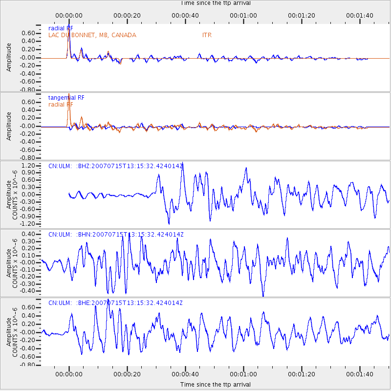
Signal To Noise
| Channel | StoN | STA | LTA |
| CN:ULM: :BHN:20070715T13:15:32.424014Z | 1.6984223 | 1.3844237E-7 | 8.151234E-8 |
| CN:ULM: :BHE:20070715T13:15:32.424014Z | 7.020872 | 2.666964E-7 | 3.798622E-8 |
| CN:ULM: :BHZ:20070715T13:15:32.424014Z | 8.275492 | 5.6273325E-7 | 6.7999984E-8 |
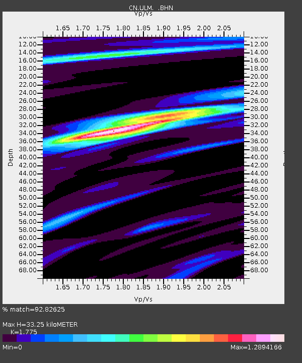
| Arrivals | |
| Ps | 4.3 SECOND |
| PpPs | 13 SECOND |
| PsPs/PpSs | 18 SECOND |

