You are here: Home > Network List > IU - Global Seismograph Network (GSN - IRIS/USGS) Stations List
> Station RSSD Black Hills, South Dakota, USA > Earthquake Result Viewer
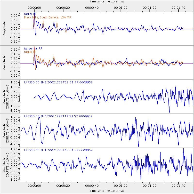
RSSD Black Hills, South Dakota, USA - Earthquake Result Viewer
*The percent match for this event was below the threshold and hence no stack was calculated.
| Earthquake location: |
Caribbean Sea |
| Earthquake latitude/longitude: |
17.0/-85.6 |
| Earthquake time(UTC): |
2002/12/23 (357) 13:46:11 GMT |
| Earthquake Depth: |
33 km |
| Earthquake Magnitude: |
5.5 MB, 5.2 MS, 6.0 MW, 5.9 MW |
| Earthquake Catalog/Contributor: |
WHDF/NEIC |
|
| Network: |
IU Global Seismograph Network (GSN - IRIS/USGS) |
| Station: |
RSSD Black Hills, South Dakota, USA |
| Lat/Lon: |
44.12 N/104.04 W |
| Elevation: |
2060 m |
|
| Distance: |
31.2 deg |
| Az: |
333.923 deg |
| Baz: |
144.258 deg |
| Ray Param: |
$rayparam |
*The percent match for this event was below the threshold and hence was not used in the summary stack. |
|
| Radial Match: |
63.517063 % |
| Radial Bump: |
400 |
| Transverse Match: |
70.29291 % |
| Transverse Bump: |
400 |
| SOD ConfigId: |
590571 |
| Insert Time: |
2013-09-25 00:50:24.745 +0000 |
| GWidth: |
2.5 |
| Max Bumps: |
400 |
| Tol: |
0.001 |
|
Signal To Noise
| Channel | StoN | STA | LTA |
| IU:RSSD:00:BHZ:20021223T13:51:57.660995Z | 3.58919 | 7.555281E-7 | 2.10501E-7 |
| IU:RSSD:00:BH1:20021223T13:51:57.660995Z | 0.7141985 | 1.18776434E-7 | 1.663073E-7 |
| IU:RSSD:00:BH2:20021223T13:51:57.660995Z | 1.941998 | 3.690825E-7 | 1.9005297E-7 |
| Arrivals |
| Ps | |
| PpPs | |
| PsPs/PpSs | |


