You are here: Home > Network List > IU - Global Seismograph Network (GSN - IRIS/USGS) Stations List
> Station JOHN Johnston Island, USA > Earthquake Result Viewer
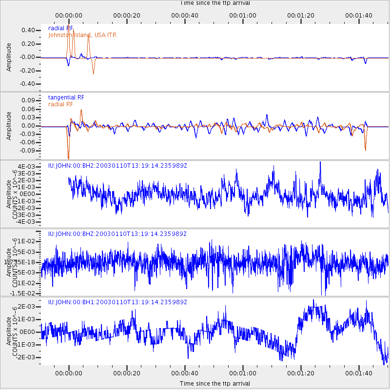
JOHN Johnston Island, USA - Earthquake Result Viewer
*The percent match for this event was below the threshold and hence no stack was calculated.
| Earthquake location: |
New Ireland Region, P.N.G. |
| Earthquake latitude/longitude: |
-5.3/153.7 |
| Earthquake time(UTC): |
2003/01/10 (010) 13:11:56 GMT |
| Earthquake Depth: |
72 km |
| Earthquake Magnitude: |
5.9 MB, 6.7 MW, 6.6 MW |
| Earthquake Catalog/Contributor: |
WHDF/NEIC |
|
| Network: |
IU Global Seismograph Network (GSN - IRIS/USGS) |
| Station: |
JOHN Johnston Island, USA |
| Lat/Lon: |
16.73 N/169.53 W |
| Elevation: |
2.0 m |
|
| Distance: |
42.4 deg |
| Az: |
58.209 deg |
| Baz: |
242.044 deg |
| Ray Param: |
$rayparam |
*The percent match for this event was below the threshold and hence was not used in the summary stack. |
|
| Radial Match: |
56.25205 % |
| Radial Bump: |
400 |
| Transverse Match: |
20.089134 % |
| Transverse Bump: |
400 |
| SOD ConfigId: |
590571 |
| Insert Time: |
2013-09-25 01:00:36.309 +0000 |
| GWidth: |
2.5 |
| Max Bumps: |
400 |
| Tol: |
0.001 |
|
Signal To Noise
| Channel | StoN | STA | LTA |
| IU:JOHN:00:BHZ:20030110T13:19:14.235989Z | 0.2575494 | 4.7543605E-9 | 1.8459993E-8 |
| IU:JOHN:00:BH1:20030110T13:19:14.235989Z | 0.30254477 | 4.2421539E-10 | 1.4021574E-9 |
| IU:JOHN:00:BH2:20030110T13:19:14.235989Z | 0.6771004 | 7.648524E-10 | 1.1295996E-9 |
| Arrivals |
| Ps | |
| PpPs | |
| PsPs/PpSs | |


