You are here: Home > Network List > IU - Global Seismograph Network (GSN - IRIS/USGS) Stations List
> Station JOHN Johnston Island, USA > Earthquake Result Viewer
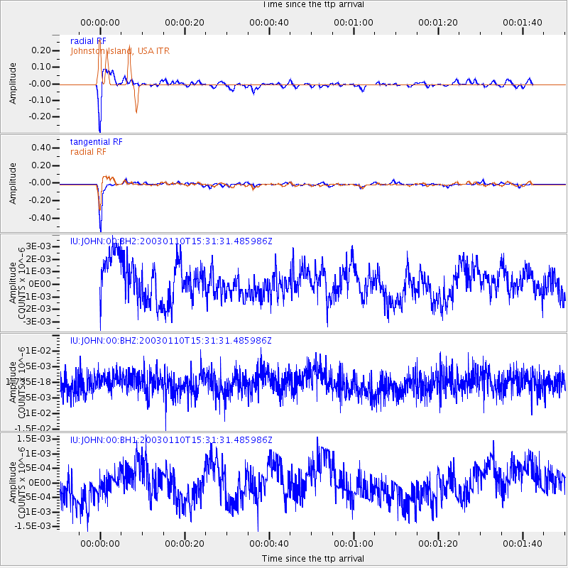
JOHN Johnston Island, USA - Earthquake Result Viewer
*The percent match for this event was below the threshold and hence no stack was calculated.
| Earthquake location: |
Northern Sumatra, Indonesia |
| Earthquake latitude/longitude: |
0.2/98.0 |
| Earthquake time(UTC): |
2003/01/10 (010) 15:18:55 GMT |
| Earthquake Depth: |
27 km |
| Earthquake Magnitude: |
5.5 MB, 5.5 MS, 5.7 MW |
| Earthquake Catalog/Contributor: |
NEIC PDE/NEIC PDE-M |
|
| Network: |
IU Global Seismograph Network (GSN - IRIS/USGS) |
| Station: |
JOHN Johnston Island, USA |
| Lat/Lon: |
16.73 N/169.53 W |
| Elevation: |
2.0 m |
|
| Distance: |
92.4 deg |
| Az: |
73.35 deg |
| Baz: |
270.912 deg |
| Ray Param: |
$rayparam |
*The percent match for this event was below the threshold and hence was not used in the summary stack. |
|
| Radial Match: |
79.552025 % |
| Radial Bump: |
390 |
| Transverse Match: |
93.26159 % |
| Transverse Bump: |
225 |
| SOD ConfigId: |
590571 |
| Insert Time: |
2013-09-25 01:01:05.517 +0000 |
| GWidth: |
2.5 |
| Max Bumps: |
400 |
| Tol: |
0.001 |
|
Signal To Noise
| Channel | StoN | STA | LTA |
| IU:JOHN:00:BHZ:20030110T15:31:31.485986Z | 0.62315136 | 3.0402945E-9 | 4.878902E-9 |
| IU:JOHN:00:BH1:20030110T15:31:31.485986Z | 0.36211056 | 3.3497238E-10 | 9.250556E-10 |
| IU:JOHN:00:BH2:20030110T15:31:31.485986Z | 0.59724206 | 9.839516E-10 | 1.6474921E-9 |
| Arrivals |
| Ps | |
| PpPs | |
| PsPs/PpSs | |


