You are here: Home > Network List > IU - Global Seismograph Network (GSN - IRIS/USGS) Stations List
> Station JOHN Johnston Island, USA > Earthquake Result Viewer
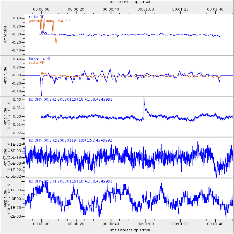
JOHN Johnston Island, USA - Earthquake Result Viewer
*The percent match for this event was below the threshold and hence no stack was calculated.
| Earthquake location: |
New Ireland Region, P.N.G. |
| Earthquake latitude/longitude: |
-5.2/153.6 |
| Earthquake time(UTC): |
2003/01/19 (019) 18:34:42 GMT |
| Earthquake Depth: |
84 km |
| Earthquake Magnitude: |
5.5 MW |
| Earthquake Catalog/Contributor: |
NEIC PDE/NEIC PDE-M |
|
| Network: |
IU Global Seismograph Network (GSN - IRIS/USGS) |
| Station: |
JOHN Johnston Island, USA |
| Lat/Lon: |
16.73 N/169.53 W |
| Elevation: |
2.0 m |
|
| Distance: |
42.4 deg |
| Az: |
58.359 deg |
| Baz: |
242.238 deg |
| Ray Param: |
$rayparam |
*The percent match for this event was below the threshold and hence was not used in the summary stack. |
|
| Radial Match: |
70.30443 % |
| Radial Bump: |
400 |
| Transverse Match: |
46.832672 % |
| Transverse Bump: |
400 |
| SOD ConfigId: |
590571 |
| Insert Time: |
2013-09-25 01:04:05.630 +0000 |
| GWidth: |
2.5 |
| Max Bumps: |
400 |
| Tol: |
0.001 |
|
Signal To Noise
| Channel | StoN | STA | LTA |
| IU:JOHN:00:BHZ:20030119T18:41:58.434999Z | 0.9794113 | 3.767759E-9 | 3.846963E-9 |
| IU:JOHN:00:BH1:20030119T18:41:58.434999Z | 2.7531776 | 1.706055E-9 | 6.196676E-10 |
| IU:JOHN:00:BH2:20030119T18:41:58.434999Z | 1.3609529 | 1.7371634E-9 | 1.2764317E-9 |
| Arrivals |
| Ps | |
| PpPs | |
| PsPs/PpSs | |


