ULM LAC DU BONNET, MB, CANADA - Earthquake Result Viewer
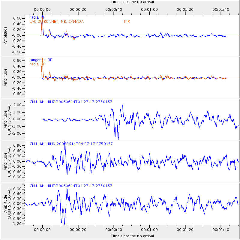
Earthquake location: Rat Islands, Aleutian Islands
Earthquake latitude/longitude: 51.8/177.1
Earthquake time(UTC): 2006/06/14 (165) 04:18:42 GMT
Earthquake Depth: 14 km
Earthquake Magnitude: 5.9 MB, 6.4 MS, 6.4 MW, 6.4 MW
Earthquake Catalog/Contributor: WHDF/NEIC
Network: CN Canadian National Seismograph Network
Station: ULM LAC DU BONNET, MB, CANADA
Lat/Lon: 50.25 N/95.87 W
Elevation: 251 m
Distance: 51.6 deg
Az: 54.894 deg
Baz: 307.611 deg
Ray Param: 0.0672999
Estimated Moho Depth: 34.5 km
Estimated Crust Vp/Vs: 1.74
Assumed Crust Vp: 6.459 km/s
Estimated Crust Vs: 3.718 km/s
Estimated Crust Poisson's Ratio: 0.25
Radial Match: 91.95539 %
Radial Bump: 344
Transverse Match: 62.975685 %
Transverse Bump: 400
SOD ConfigId: 5745
Insert Time: 2010-02-27 07:34:39.452 +0000
GWidth: 2.5
Max Bumps: 400
Tol: 0.001

Signal To Noise

ChannelStoNSTALTA
CN:ULM: :BHN:20060614T04:27:17.275015Z1.52039851.2489113E-78.2143686E-8
CN:ULM: :BHE:20060614T04:27:17.275015Z3.91282441.6614455E-74.246154E-8
CN:ULM: :BHZ:20060614T04:27:17.275015Z3.46821933.425414E-79.876578E-8
Arrivals
Ps4.2 SECOND
PpPs14 SECOND
PsPs/PpSs18 SECOND