You are here: Home > Network List > TA - USArray Transportable Network (new EarthScope stations) Stations List
> Station I49A Point Hope, MI, USA > Earthquake Result Viewer
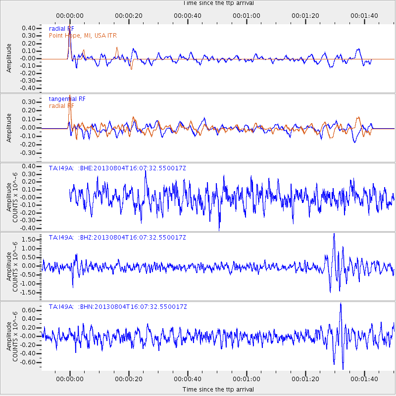
I49A Point Hope, MI, USA - Earthquake Result Viewer
*The percent match for this event was below the threshold and hence no stack was calculated.
| Earthquake location: |
Sea Of Okhotsk |
| Earthquake latitude/longitude: |
47.0/145.2 |
| Earthquake time(UTC): |
2013/08/04 (216) 15:56:34 GMT |
| Earthquake Depth: |
375 km |
| Earthquake Magnitude: |
5.8 MW, 5.8 MW |
| Earthquake Catalog/Contributor: |
NEIC PDE/NEIC PDE-W |
|
| Network: |
TA USArray Transportable Network (new EarthScope stations) |
| Station: |
I49A Point Hope, MI, USA |
| Lat/Lon: |
43.94 N/82.82 W |
| Elevation: |
217 m |
|
| Distance: |
80.0 deg |
| Az: |
33.057 deg |
| Baz: |
328.873 deg |
| Ray Param: |
$rayparam |
*The percent match for this event was below the threshold and hence was not used in the summary stack. |
|
| Radial Match: |
54.447872 % |
| Radial Bump: |
400 |
| Transverse Match: |
45.49773 % |
| Transverse Bump: |
400 |
| SOD ConfigId: |
589702 |
| Insert Time: |
2013-09-25 01:13:09.927 +0000 |
| GWidth: |
2.5 |
| Max Bumps: |
400 |
| Tol: |
0.001 |
|
Signal To Noise
| Channel | StoN | STA | LTA |
| TA:I49A: :BHZ:20130804T16:07:32.550017Z | 2.4799218 | 3.7436507E-7 | 1.5095841E-7 |
| TA:I49A: :BHN:20130804T16:07:32.550017Z | 1.3186089 | 1.3532367E-7 | 1.0262609E-7 |
| TA:I49A: :BHE:20130804T16:07:32.550017Z | 1.0987628 | 1.1778548E-7 | 1.0719828E-7 |
| Arrivals |
| Ps | |
| PpPs | |
| PsPs/PpSs | |


