You are here: Home > Network List > TA - USArray Transportable Network (new EarthScope stations) Stations List
> Station J47A Sunmer, MI, USA > Earthquake Result Viewer
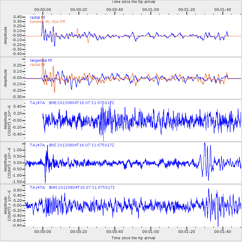
J47A Sunmer, MI, USA - Earthquake Result Viewer
*The percent match for this event was below the threshold and hence no stack was calculated.
| Earthquake location: |
Sea Of Okhotsk |
| Earthquake latitude/longitude: |
47.0/145.2 |
| Earthquake time(UTC): |
2013/08/04 (216) 15:56:34 GMT |
| Earthquake Depth: |
375 km |
| Earthquake Magnitude: |
5.8 MW, 5.8 MW |
| Earthquake Catalog/Contributor: |
NEIC PDE/NEIC PDE-W |
|
| Network: |
TA USArray Transportable Network (new EarthScope stations) |
| Station: |
J47A Sunmer, MI, USA |
| Lat/Lon: |
43.24 N/84.82 W |
| Elevation: |
236 m |
|
| Distance: |
79.8 deg |
| Az: |
34.685 deg |
| Baz: |
327.786 deg |
| Ray Param: |
$rayparam |
*The percent match for this event was below the threshold and hence was not used in the summary stack. |
|
| Radial Match: |
59.954193 % |
| Radial Bump: |
400 |
| Transverse Match: |
52.29342 % |
| Transverse Bump: |
400 |
| SOD ConfigId: |
589702 |
| Insert Time: |
2013-09-25 01:13:28.927 +0000 |
| GWidth: |
2.5 |
| Max Bumps: |
400 |
| Tol: |
0.001 |
|
Signal To Noise
| Channel | StoN | STA | LTA |
| TA:J47A: :BHZ:20130804T16:07:31.675017Z | 3.823637 | 4.661907E-7 | 1.2192336E-7 |
| TA:J47A: :BHN:20130804T16:07:31.675017Z | 1.9492906 | 1.9581778E-7 | 1.00455914E-7 |
| TA:J47A: :BHE:20130804T16:07:31.675017Z | 1.9571977 | 2.1175657E-7 | 1.0819375E-7 |
| Arrivals |
| Ps | |
| PpPs | |
| PsPs/PpSs | |


