You are here: Home > Network List > TA - USArray Transportable Network (new EarthScope stations) Stations List
> Station P43A Skaggs, Pawnee, IL, USA > Earthquake Result Viewer
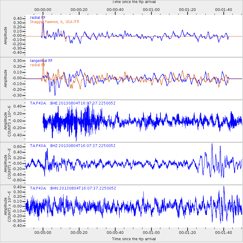
P43A Skaggs, Pawnee, IL, USA - Earthquake Result Viewer
*The percent match for this event was below the threshold and hence no stack was calculated.
| Earthquake location: |
Sea Of Okhotsk |
| Earthquake latitude/longitude: |
47.0/145.2 |
| Earthquake time(UTC): |
2013/08/04 (216) 15:56:34 GMT |
| Earthquake Depth: |
375 km |
| Earthquake Magnitude: |
5.8 MW, 5.8 MW |
| Earthquake Catalog/Contributor: |
NEIC PDE/NEIC PDE-W |
|
| Network: |
TA USArray Transportable Network (new EarthScope stations) |
| Station: |
P43A Skaggs, Pawnee, IL, USA |
| Lat/Lon: |
39.64 N/89.52 W |
| Elevation: |
176 m |
|
| Distance: |
80.9 deg |
| Az: |
39.682 deg |
| Baz: |
325.52 deg |
| Ray Param: |
$rayparam |
*The percent match for this event was below the threshold and hence was not used in the summary stack. |
|
| Radial Match: |
52.4318 % |
| Radial Bump: |
400 |
| Transverse Match: |
51.277344 % |
| Transverse Bump: |
400 |
| SOD ConfigId: |
589702 |
| Insert Time: |
2013-09-25 01:16:37.410 +0000 |
| GWidth: |
2.5 |
| Max Bumps: |
400 |
| Tol: |
0.001 |
|
Signal To Noise
| Channel | StoN | STA | LTA |
| TA:P43A: :BHZ:20130804T16:07:37.225005Z | 2.4063213 | 2.0668901E-7 | 8.589419E-8 |
| TA:P43A: :BHN:20130804T16:07:37.225005Z | 0.8721615 | 9.956841E-8 | 1.1416281E-7 |
| TA:P43A: :BHE:20130804T16:07:37.225005Z | 0.7513158 | 1.3014385E-7 | 1.7322124E-7 |
| Arrivals |
| Ps | |
| PpPs | |
| PsPs/PpSs | |


