You are here: Home > Network List > TA - USArray Transportable Network (new EarthScope stations) Stations List
> Station P48A Milroy, IN, USA > Earthquake Result Viewer
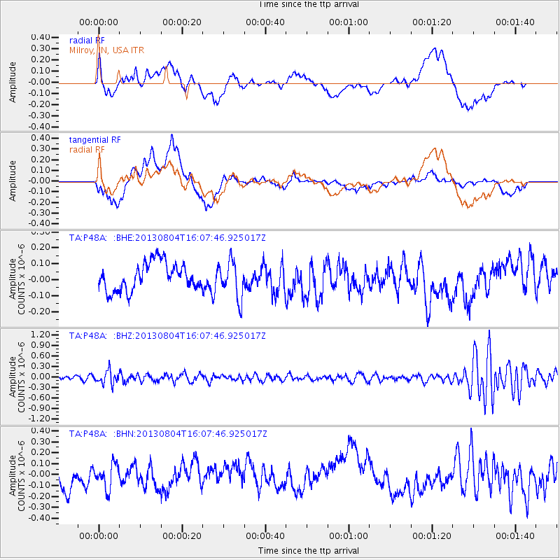
P48A Milroy, IN, USA - Earthquake Result Viewer
*The percent match for this event was below the threshold and hence no stack was calculated.
| Earthquake location: |
Sea Of Okhotsk |
| Earthquake latitude/longitude: |
47.0/145.2 |
| Earthquake time(UTC): |
2013/08/04 (216) 15:56:34 GMT |
| Earthquake Depth: |
375 km |
| Earthquake Magnitude: |
5.8 MW, 5.8 MW |
| Earthquake Catalog/Contributor: |
NEIC PDE/NEIC PDE-W |
|
| Network: |
TA USArray Transportable Network (new EarthScope stations) |
| Station: |
P48A Milroy, IN, USA |
| Lat/Lon: |
39.46 N/85.43 W |
| Elevation: |
300 m |
|
| Distance: |
82.8 deg |
| Az: |
37.111 deg |
| Baz: |
327.754 deg |
| Ray Param: |
$rayparam |
*The percent match for this event was below the threshold and hence was not used in the summary stack. |
|
| Radial Match: |
29.208096 % |
| Radial Bump: |
400 |
| Transverse Match: |
33.39936 % |
| Transverse Bump: |
400 |
| SOD ConfigId: |
589702 |
| Insert Time: |
2013-09-25 01:16:42.505 +0000 |
| GWidth: |
2.5 |
| Max Bumps: |
400 |
| Tol: |
0.001 |
|
Signal To Noise
| Channel | StoN | STA | LTA |
| TA:P48A: :BHZ:20130804T16:07:46.925017Z | 2.3061056 | 1.8747423E-7 | 8.129473E-8 |
| TA:P48A: :BHN:20130804T16:07:46.925017Z | 0.84885895 | 1.3967417E-7 | 1.6454344E-7 |
| TA:P48A: :BHE:20130804T16:07:46.925017Z | 1.3865261 | 1.1804941E-7 | 8.5140414E-8 |
| Arrivals |
| Ps | |
| PpPs | |
| PsPs/PpSs | |


