You are here: Home > Network List > TA - USArray Transportable Network (new EarthScope stations) Stations List
> Station R49A Shelbyville, KY, USA > Earthquake Result Viewer
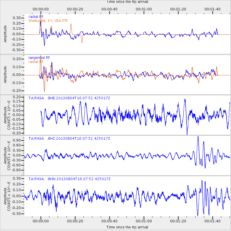
R49A Shelbyville, KY, USA - Earthquake Result Viewer
*The percent match for this event was below the threshold and hence no stack was calculated.
| Earthquake location: |
Sea Of Okhotsk |
| Earthquake latitude/longitude: |
47.0/145.2 |
| Earthquake time(UTC): |
2013/08/04 (216) 15:56:34 GMT |
| Earthquake Depth: |
375 km |
| Earthquake Magnitude: |
5.8 MW, 5.8 MW |
| Earthquake Catalog/Contributor: |
NEIC PDE/NEIC PDE-W |
|
| Network: |
TA USArray Transportable Network (new EarthScope stations) |
| Station: |
R49A Shelbyville, KY, USA |
| Lat/Lon: |
38.29 N/85.17 W |
| Elevation: |
251 m |
|
| Distance: |
83.9 deg |
| Az: |
37.566 deg |
| Baz: |
327.966 deg |
| Ray Param: |
$rayparam |
*The percent match for this event was below the threshold and hence was not used in the summary stack. |
|
| Radial Match: |
48.122032 % |
| Radial Bump: |
400 |
| Transverse Match: |
35.227596 % |
| Transverse Bump: |
400 |
| SOD ConfigId: |
589702 |
| Insert Time: |
2013-09-25 01:17:42.299 +0000 |
| GWidth: |
2.5 |
| Max Bumps: |
400 |
| Tol: |
0.001 |
|
Signal To Noise
| Channel | StoN | STA | LTA |
| TA:R49A: :BHZ:20130804T16:07:52.425017Z | 3.146906 | 1.8348227E-7 | 5.8305613E-8 |
| TA:R49A: :BHN:20130804T16:07:52.425017Z | 1.4724841 | 7.420099E-8 | 5.039171E-8 |
| TA:R49A: :BHE:20130804T16:07:52.425017Z | 0.86920005 | 4.8712796E-8 | 5.6043252E-8 |
| Arrivals |
| Ps | |
| PpPs | |
| PsPs/PpSs | |


