You are here: Home > Network List > IU - Global Seismograph Network (GSN - IRIS/USGS) Stations List
> Station JOHN Johnston Island, USA > Earthquake Result Viewer
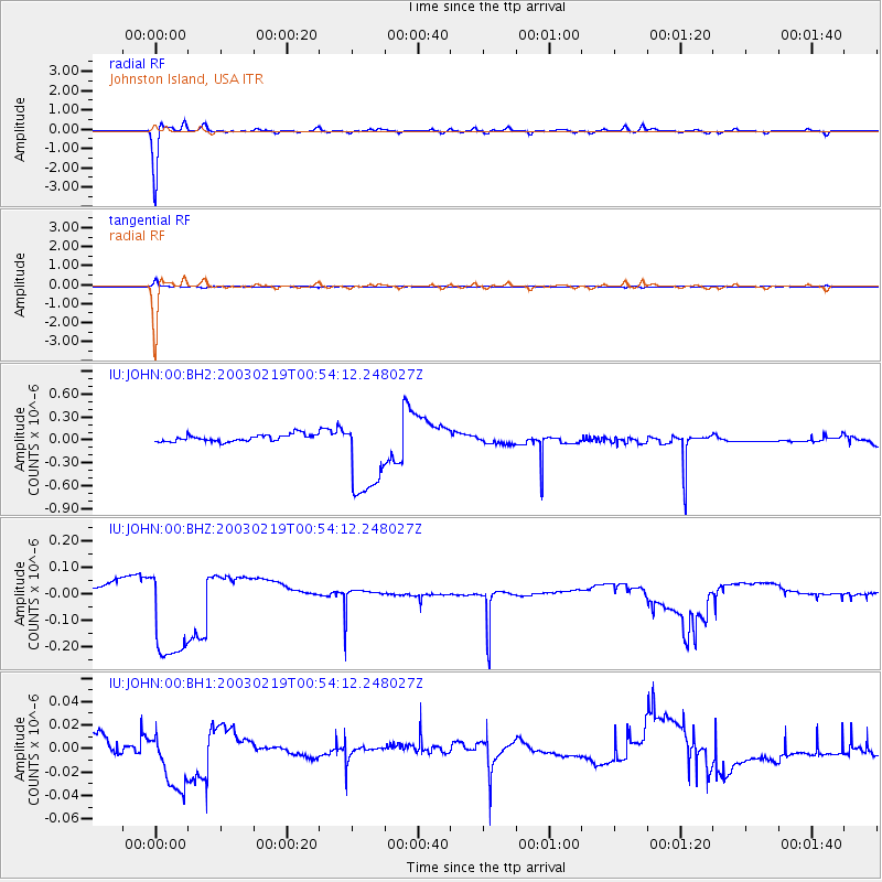
JOHN Johnston Island, USA - Earthquake Result Viewer
*The percent match for this event was below the threshold and hence no stack was calculated.
| Earthquake location: |
Pacific-Antarctic Ridge |
| Earthquake latitude/longitude: |
-56.9/-142.8 |
| Earthquake time(UTC): |
2003/02/19 (050) 00:42:52 GMT |
| Earthquake Depth: |
10 km |
| Earthquake Magnitude: |
5.6 MW |
| Earthquake Catalog/Contributor: |
NEIC PDE/NEIC PDE-M |
|
| Network: |
IU Global Seismograph Network (GSN - IRIS/USGS) |
| Station: |
JOHN Johnston Island, USA |
| Lat/Lon: |
16.73 N/169.53 W |
| Elevation: |
2.0 m |
|
| Distance: |
76.7 deg |
| Az: |
333.717 deg |
| Baz: |
165.327 deg |
| Ray Param: |
$rayparam |
*The percent match for this event was below the threshold and hence was not used in the summary stack. |
|
| Radial Match: |
95.47703 % |
| Radial Bump: |
266 |
| Transverse Match: |
85.07181 % |
| Transverse Bump: |
373 |
| SOD ConfigId: |
590571 |
| Insert Time: |
2013-09-25 01:18:34.022 +0000 |
| GWidth: |
2.5 |
| Max Bumps: |
400 |
| Tol: |
0.001 |
|
Signal To Noise
| Channel | StoN | STA | LTA |
| IU:JOHN:00:BHZ:20030219T00:54:12.248027Z | 10.464279 | 2.1164973E-7 | 2.0225926E-8 |
| IU:JOHN:00:BH1:20030219T00:54:12.248027Z | 4.3518333 | 2.7790804E-8 | 6.385999E-9 |
| IU:JOHN:00:BH2:20030219T00:54:12.248027Z | 12.737487 | 5.787691E-7 | 4.543825E-8 |
| Arrivals |
| Ps | |
| PpPs | |
| PsPs/PpSs | |


