You are here: Home > Network List > TA - USArray Transportable Network (new EarthScope stations) Stations List
> Station W52A Murphy, NC, USA > Earthquake Result Viewer
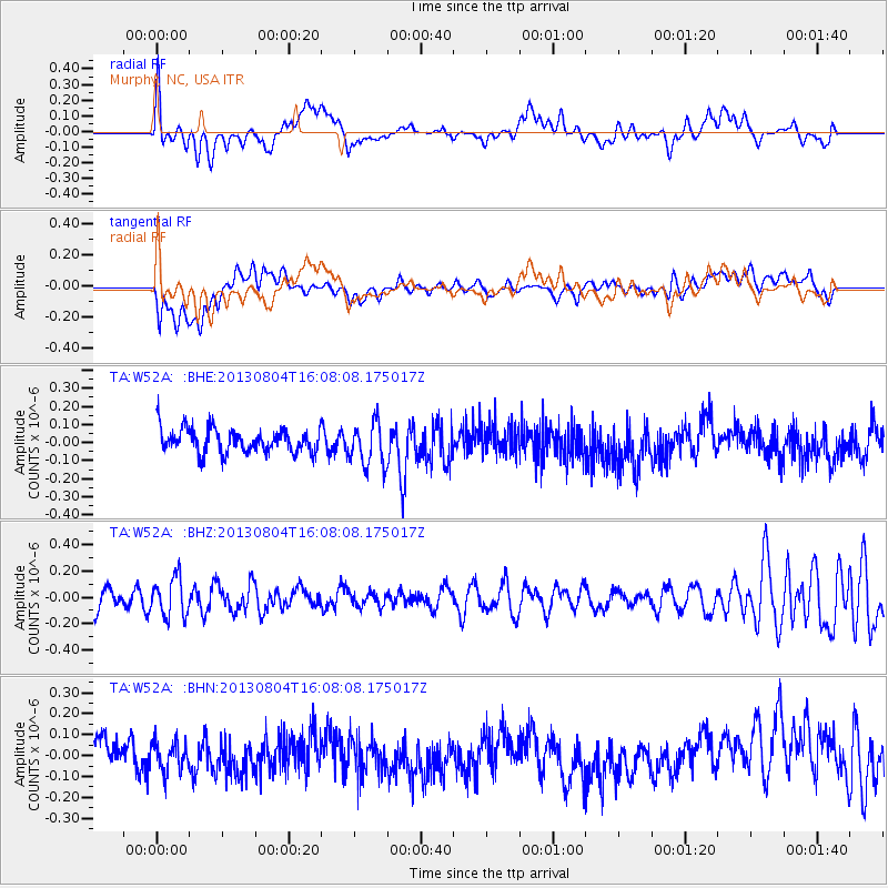
W52A Murphy, NC, USA - Earthquake Result Viewer
*The percent match for this event was below the threshold and hence no stack was calculated.
| Earthquake location: |
Sea Of Okhotsk |
| Earthquake latitude/longitude: |
47.0/145.2 |
| Earthquake time(UTC): |
2013/08/04 (216) 15:56:34 GMT |
| Earthquake Depth: |
375 km |
| Earthquake Magnitude: |
5.8 MW, 5.8 MW |
| Earthquake Catalog/Contributor: |
NEIC PDE/NEIC PDE-W |
|
| Network: |
TA USArray Transportable Network (new EarthScope stations) |
| Station: |
W52A Murphy, NC, USA |
| Lat/Lon: |
35.09 N/83.93 W |
| Elevation: |
519 m |
|
| Distance: |
87.1 deg |
| Az: |
38.392 deg |
| Baz: |
328.77 deg |
| Ray Param: |
$rayparam |
*The percent match for this event was below the threshold and hence was not used in the summary stack. |
|
| Radial Match: |
50.056725 % |
| Radial Bump: |
400 |
| Transverse Match: |
29.030212 % |
| Transverse Bump: |
400 |
| SOD ConfigId: |
589702 |
| Insert Time: |
2013-09-25 01:20:01.651 +0000 |
| GWidth: |
2.5 |
| Max Bumps: |
400 |
| Tol: |
0.001 |
|
Signal To Noise
| Channel | StoN | STA | LTA |
| TA:W52A: :BHZ:20130804T16:08:08.175017Z | 1.6225258 | 1.492466E-7 | 9.198412E-8 |
| TA:W52A: :BHN:20130804T16:08:08.175017Z | 1.1557292 | 7.049088E-8 | 6.0992555E-8 |
| TA:W52A: :BHE:20130804T16:08:08.175017Z | 1.7978386 | 1.211473E-7 | 6.7384974E-8 |
| Arrivals |
| Ps | |
| PpPs | |
| PsPs/PpSs | |


