You are here: Home > Network List > CN - Canadian National Seismograph Network Stations List
> Station ULM LAC DU BONNET, MB, CANADA > Earthquake Result Viewer
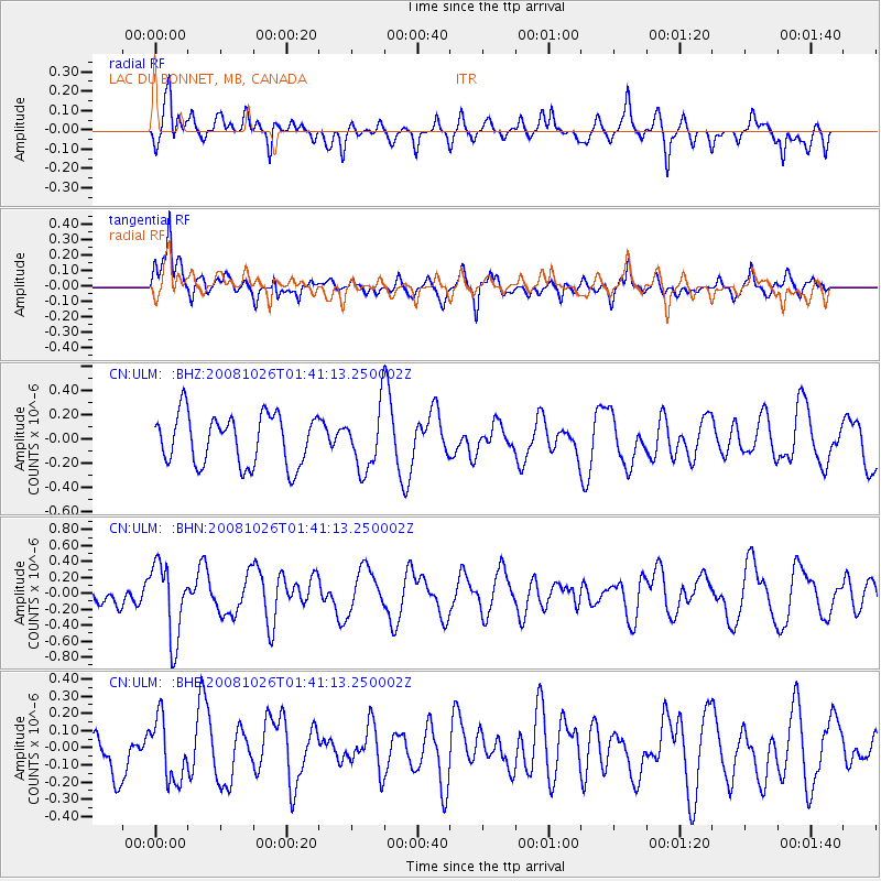
ULM LAC DU BONNET, MB, CANADA - Earthquake Result Viewer
*The percent match for this event was below the threshold and hence no stack was calculated.
| Earthquake location: |
Hindu Kush Region, Afghanistan |
| Earthquake latitude/longitude: |
36.5/70.7 |
| Earthquake time(UTC): |
2008/10/26 (300) 01:28:56 GMT |
| Earthquake Depth: |
210 km |
| Earthquake Magnitude: |
5.5 MB, 5.7 MW, 5.7 MW |
| Earthquake Catalog/Contributor: |
WHDF/NEIC |
|
| Network: |
CN Canadian National Seismograph Network |
| Station: |
ULM LAC DU BONNET, MB, CANADA |
| Lat/Lon: |
50.25 N/95.87 W |
| Elevation: |
251 m |
|
| Distance: |
92.8 deg |
| Az: |
351.407 deg |
| Baz: |
10.81 deg |
| Ray Param: |
$rayparam |
*The percent match for this event was below the threshold and hence was not used in the summary stack. |
|
| Radial Match: |
53.8143 % |
| Radial Bump: |
400 |
| Transverse Match: |
62.20162 % |
| Transverse Bump: |
400 |
| SOD ConfigId: |
2560 |
| Insert Time: |
2010-02-27 07:35:52.564 +0000 |
| GWidth: |
2.5 |
| Max Bumps: |
400 |
| Tol: |
0.001 |
|
Signal To Noise
| Channel | StoN | STA | LTA |
| CN:ULM: :BHN:20081026T01:41:13.250002Z | 2.387661 | 4.6793932E-7 | 1.9598231E-7 |
| CN:ULM: :BHE:20081026T01:41:13.250002Z | 1.0775338 | 1.7962205E-7 | 1.6669736E-7 |
| CN:ULM: :BHZ:20081026T01:41:13.250002Z | 1.1992273 | 2.505687E-7 | 2.089418E-7 |
| Arrivals |
| Ps | |
| PpPs | |
| PsPs/PpSs | |


