You are here: Home > Network List > TA - USArray Transportable Network (new EarthScope stations) Stations List
> Station 833A Chaparral WMA, Artesia Wells, TX, USA > Earthquake Result Viewer
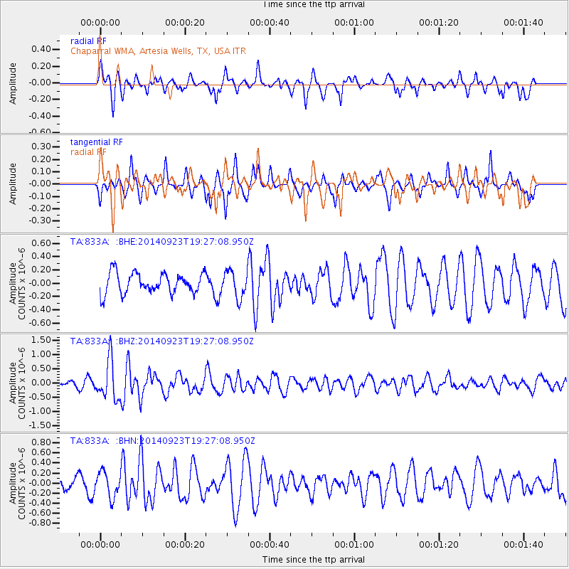
833A Chaparral WMA, Artesia Wells, TX, USA - Earthquake Result Viewer
*The percent match for this event was below the threshold and hence no stack was calculated.
| Earthquake location: |
Reykjanes Ridge |
| Earthquake latitude/longitude: |
53.1/-35.1 |
| Earthquake time(UTC): |
2014/09/23 (266) 19:18:25 GMT |
| Earthquake Depth: |
7.2 km |
| Earthquake Magnitude: |
5.4 MW |
| Earthquake Catalog/Contributor: |
ISC/ISC |
|
| Network: |
TA USArray Transportable Network (new EarthScope stations) |
| Station: |
833A Chaparral WMA, Artesia Wells, TX, USA |
| Lat/Lon: |
28.32 N/99.39 W |
| Elevation: |
171 m |
|
| Distance: |
52.6 deg |
| Az: |
268.495 deg |
| Baz: |
43.076 deg |
| Ray Param: |
$rayparam |
*The percent match for this event was below the threshold and hence was not used in the summary stack. |
|
| Radial Match: |
65.60662 % |
| Radial Bump: |
385 |
| Transverse Match: |
62.382317 % |
| Transverse Bump: |
252 |
| SOD ConfigId: |
3390531 |
| Insert Time: |
2019-04-14 04:49:32.924 +0000 |
| GWidth: |
2.5 |
| Max Bumps: |
400 |
| Tol: |
0.001 |
|
Signal To Noise
| Channel | StoN | STA | LTA |
| TA:833A: :BHZ:20140923T19:27:08.950Z | 6.7627316 | 7.21376E-7 | 1.06669326E-7 |
| TA:833A: :BHN:20140923T19:27:08.950Z | 1.4718667 | 2.587937E-7 | 1.7582686E-7 |
| TA:833A: :BHE:20140923T19:27:08.950Z | 1.3633082 | 2.0774887E-7 | 1.5238584E-7 |
| Arrivals |
| Ps | |
| PpPs | |
| PsPs/PpSs | |


