You are here: Home > Network List > UW - Pacific Northwest Regional Seismic Network Stations List
> Station LEBA Lebam, WA, USA > Earthquake Result Viewer
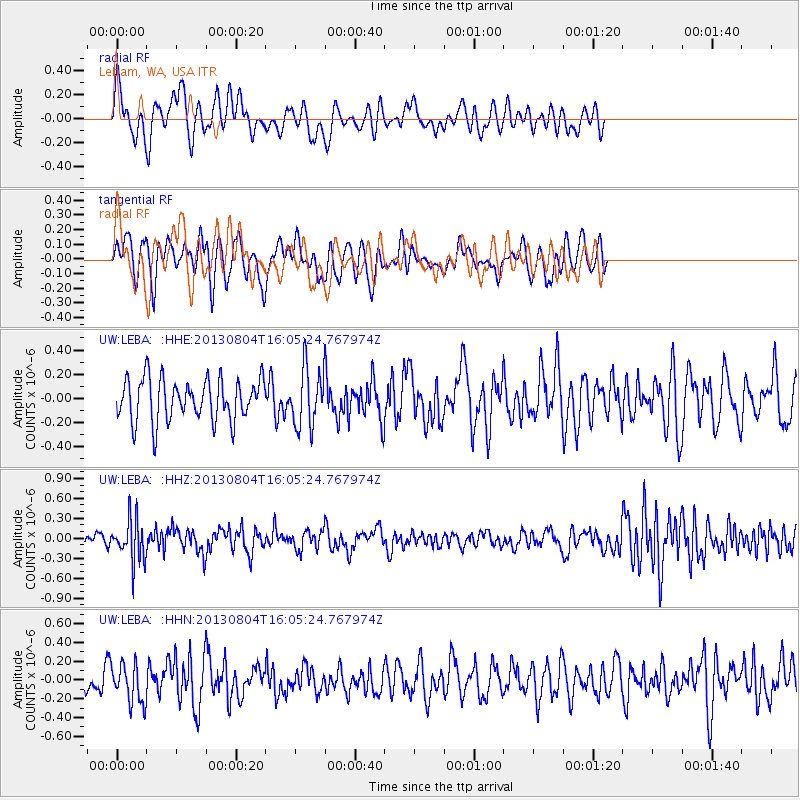
LEBA Lebam, WA, USA - Earthquake Result Viewer
*The percent match for this event was below the threshold and hence no stack was calculated.
| Earthquake location: |
Sea Of Okhotsk |
| Earthquake latitude/longitude: |
47.0/145.2 |
| Earthquake time(UTC): |
2013/08/04 (216) 15:56:34 GMT |
| Earthquake Depth: |
375 km |
| Earthquake Magnitude: |
5.8 MW, 5.8 MW |
| Earthquake Catalog/Contributor: |
NEIC PDE/NEIC PDE-W |
|
| Network: |
UW Pacific Northwest Regional Seismic Network |
| Station: |
LEBA Lebam, WA, USA |
| Lat/Lon: |
46.55 N/123.56 W |
| Elevation: |
73 m |
|
| Distance: |
58.8 deg |
| Az: |
53.744 deg |
| Baz: |
306.886 deg |
| Ray Param: |
$rayparam |
*The percent match for this event was below the threshold and hence was not used in the summary stack. |
|
| Radial Match: |
53.541134 % |
| Radial Bump: |
400 |
| Transverse Match: |
50.66433 % |
| Transverse Bump: |
400 |
| SOD ConfigId: |
589702 |
| Insert Time: |
2013-09-25 01:24:34.242 +0000 |
| GWidth: |
2.5 |
| Max Bumps: |
400 |
| Tol: |
0.001 |
|
Signal To Noise
| Channel | StoN | STA | LTA |
| UW:LEBA: :HHZ:20130804T16:05:24.767974Z | 2.9847434 | 3.1573146E-7 | 1.0578178E-7 |
| UW:LEBA: :HHN:20130804T16:05:24.767974Z | 1.1420748 | 2.0151346E-7 | 1.7644504E-7 |
| UW:LEBA: :HHE:20130804T16:05:24.767974Z | 1.3528597 | 2.3627621E-7 | 1.7464946E-7 |
| Arrivals |
| Ps | |
| PpPs | |
| PsPs/PpSs | |


