You are here: Home > Network List > IU - Global Seismograph Network (GSN - IRIS/USGS) Stations List
> Station JOHN Johnston Island, USA > Earthquake Result Viewer
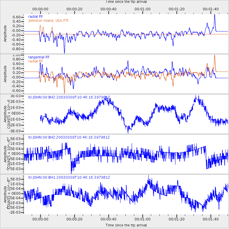
JOHN Johnston Island, USA - Earthquake Result Viewer
*The percent match for this event was below the threshold and hence no stack was calculated.
| Earthquake location: |
Banda Sea |
| Earthquake latitude/longitude: |
-6.8/131.0 |
| Earthquake time(UTC): |
2003/03/09 (068) 10:36:23 GMT |
| Earthquake Depth: |
46 km |
| Earthquake Magnitude: |
5.9 MB, 5.4 MS, 5.9 MW, 5.9 MW |
| Earthquake Catalog/Contributor: |
WHDF/NEIC |
|
| Network: |
IU Global Seismograph Network (GSN - IRIS/USGS) |
| Station: |
JOHN Johnston Island, USA |
| Lat/Lon: |
16.73 N/169.53 W |
| Elevation: |
2.0 m |
|
| Distance: |
63.3 deg |
| Az: |
67.523 deg |
| Baz: |
253.26 deg |
| Ray Param: |
$rayparam |
*The percent match for this event was below the threshold and hence was not used in the summary stack. |
|
| Radial Match: |
65.09746 % |
| Radial Bump: |
400 |
| Transverse Match: |
37.666454 % |
| Transverse Bump: |
400 |
| SOD ConfigId: |
590571 |
| Insert Time: |
2013-09-25 01:26:25.623 +0000 |
| GWidth: |
2.5 |
| Max Bumps: |
400 |
| Tol: |
0.001 |
|
Signal To Noise
| Channel | StoN | STA | LTA |
| IU:JOHN:00:BHZ:20030309T10:46:16.397981Z | 1.1043935 | 3.4553516E-10 | 3.1287323E-10 |
| IU:JOHN:00:BH1:20030309T10:46:16.397981Z | 1.6624655 | 1.1820845E-9 | 7.1104306E-10 |
| IU:JOHN:00:BH2:20030309T10:46:16.397981Z | 2.2720625 | 1.3872389E-9 | 6.1056366E-10 |
| Arrivals |
| Ps | |
| PpPs | |
| PsPs/PpSs | |


