You are here: Home > Network List > IU - Global Seismograph Network (GSN - IRIS/USGS) Stations List
> Station JOHN Johnston Island, USA > Earthquake Result Viewer
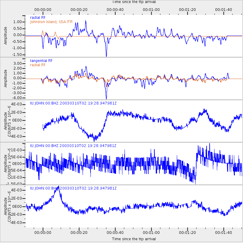
JOHN Johnston Island, USA - Earthquake Result Viewer
*The percent match for this event was below the threshold and hence no stack was calculated.
| Earthquake location: |
Halmahera, Indonesia |
| Earthquake latitude/longitude: |
1.7/127.3 |
| Earthquake time(UTC): |
2003/03/10 (069) 02:09:37 GMT |
| Earthquake Depth: |
94 km |
| Earthquake Magnitude: |
6.2 MB, 6.4 MW, 6.4 MW |
| Earthquake Catalog/Contributor: |
WHDF/NEIC |
|
| Network: |
IU Global Seismograph Network (GSN - IRIS/USGS) |
| Station: |
JOHN Johnston Island, USA |
| Lat/Lon: |
16.73 N/169.53 W |
| Elevation: |
2.0 m |
|
| Distance: |
63.9 deg |
| Az: |
72.273 deg |
| Baz: |
263.542 deg |
| Ray Param: |
$rayparam |
*The percent match for this event was below the threshold and hence was not used in the summary stack. |
|
| Radial Match: |
69.22326 % |
| Radial Bump: |
337 |
| Transverse Match: |
78.77216 % |
| Transverse Bump: |
317 |
| SOD ConfigId: |
590571 |
| Insert Time: |
2013-09-25 01:26:58.593 +0000 |
| GWidth: |
2.5 |
| Max Bumps: |
400 |
| Tol: |
0.001 |
|
Signal To Noise
| Channel | StoN | STA | LTA |
| IU:JOHN:00:BHZ:20030310T02:19:28.947981Z | 0.73336214 | 2.7506133E-10 | 3.750689E-10 |
| IU:JOHN:00:BH1:20030310T02:19:28.947981Z | 2.0129726 | 1.8212701E-9 | 9.0476643E-10 |
| IU:JOHN:00:BH2:20030310T02:19:28.947981Z | 2.1109078 | 2.7690186E-9 | 1.3117667E-9 |
| Arrivals |
| Ps | |
| PpPs | |
| PsPs/PpSs | |


