You are here: Home > Network List > IU - Global Seismograph Network (GSN - IRIS/USGS) Stations List
> Station JOHN Johnston Island, USA > Earthquake Result Viewer
JOHN Johnston Island, USA - Earthquake Result Viewer
*The percent match for this event was below the threshold and hence no stack was calculated.
| Earthquake location: |
Kermadec Islands Region |
| Earthquake latitude/longitude: |
-28.1/-177.7 |
| Earthquake time(UTC): |
2003/03/10 (069) 10:02:41 GMT |
| Earthquake Depth: |
147 km |
| Earthquake Magnitude: |
5.9 MW, 5.5 MB, 5.9 MW |
| Earthquake Catalog/Contributor: |
NEIC PDE/NEIC PDE-M |
|
| Network: |
IU Global Seismograph Network (GSN - IRIS/USGS) |
| Station: |
JOHN Johnston Island, USA |
| Lat/Lon: |
16.73 N/169.53 W |
| Elevation: |
2.0 m |
|
| Distance: |
45.2 deg |
| Az: |
11.03 deg |
| Baz: |
190.163 deg |
| Ray Param: |
$rayparam |
*The percent match for this event was below the threshold and hence was not used in the summary stack. |
|
| Radial Match: |
67.72254 % |
| Radial Bump: |
388 |
| Transverse Match: |
61.18665 % |
| Transverse Bump: |
390 |
| SOD ConfigId: |
590571 |
| Insert Time: |
2013-09-25 01:27:25.403 +0000 |
| GWidth: |
2.5 |
| Max Bumps: |
400 |
| Tol: |
0.001 |
|
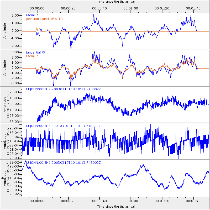
Signal To Noise
| Channel | StoN | STA | LTA |
| IU:JOHN:00:BHZ:20030310T10:10:13.748002Z | 1.0850506 | 3.7469836E-10 | 3.45328E-10 |
| IU:JOHN:00:BH1:20030310T10:10:13.748002Z | 0.21978623 | 1.2666953E-9 | 5.7633063E-9 |
| IU:JOHN:00:BH2:20030310T10:10:13.748002Z | 1.785915 | 1.7277959E-9 | 9.674569E-10 |
| Arrivals |
| Ps | |
| PpPs | |
| PsPs/PpSs | |


