You are here: Home > Network List > IU - Global Seismograph Network (GSN - IRIS/USGS) Stations List
> Station JOHN Johnston Island, USA > Earthquake Result Viewer
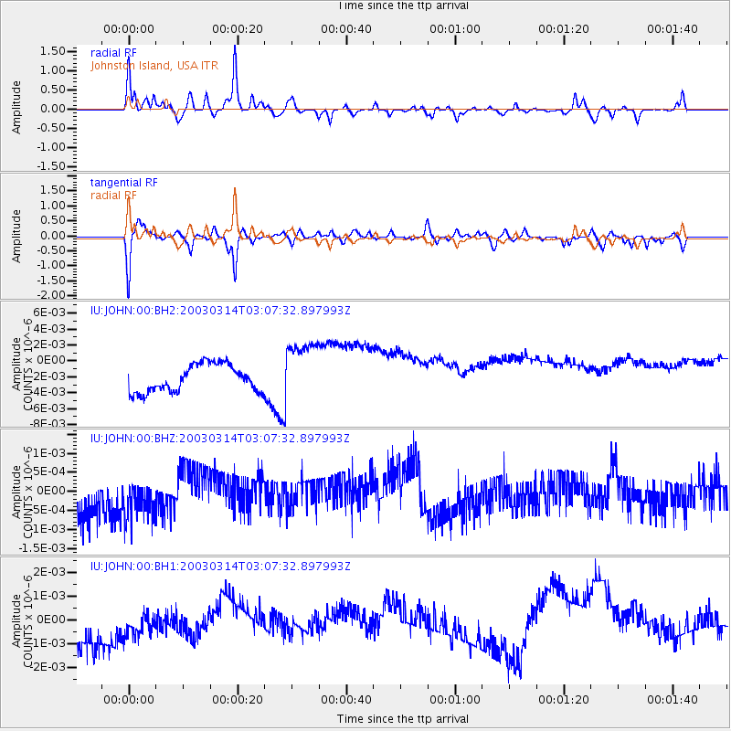
JOHN Johnston Island, USA - Earthquake Result Viewer
*The percent match for this event was below the threshold and hence no stack was calculated.
| Earthquake location: |
Balleny Islands Region |
| Earthquake latitude/longitude: |
-62.1/161.7 |
| Earthquake time(UTC): |
2003/03/14 (073) 02:55:45 GMT |
| Earthquake Depth: |
10 km |
| Earthquake Magnitude: |
5.9 MW, 5.6 MS, 5.9 MW |
| Earthquake Catalog/Contributor: |
NEIC PDE/NEIC PDE-M |
|
| Network: |
IU Global Seismograph Network (GSN - IRIS/USGS) |
| Station: |
JOHN Johnston Island, USA |
| Lat/Lon: |
16.73 N/169.53 W |
| Elevation: |
2.0 m |
|
| Distance: |
81.8 deg |
| Az: |
27.747 deg |
| Baz: |
193.212 deg |
| Ray Param: |
$rayparam |
*The percent match for this event was below the threshold and hence was not used in the summary stack. |
|
| Radial Match: |
70.75818 % |
| Radial Bump: |
355 |
| Transverse Match: |
47.348507 % |
| Transverse Bump: |
391 |
| SOD ConfigId: |
590571 |
| Insert Time: |
2013-09-25 01:29:15.631 +0000 |
| GWidth: |
2.5 |
| Max Bumps: |
400 |
| Tol: |
0.001 |
|
Signal To Noise
| Channel | StoN | STA | LTA |
| IU:JOHN:00:BHZ:20030314T03:07:32.897993Z | 0.53022623 | 7.169522E-10 | 1.3521629E-9 |
| IU:JOHN:00:BH1:20030314T03:07:32.897993Z | 0.2666938 | 5.331878E-10 | 1.999251E-9 |
| IU:JOHN:00:BH2:20030314T03:07:32.897993Z | 2.3136606 | 3.9284673E-9 | 1.6979445E-9 |
| Arrivals |
| Ps | |
| PpPs | |
| PsPs/PpSs | |


