You are here: Home > Network List > WI - West Indies IPGP Network Stations List
> Station BIM Morne Bigot, Anses d'Arlets, Martinique > Earthquake Result Viewer
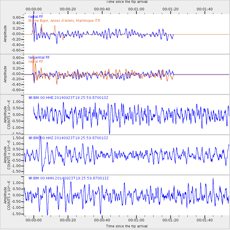
BIM Morne Bigot, Anses d'Arlets, Martinique - Earthquake Result Viewer
*The percent match for this event was below the threshold and hence no stack was calculated.
| Earthquake location: |
Reykjanes Ridge |
| Earthquake latitude/longitude: |
53.1/-35.1 |
| Earthquake time(UTC): |
2014/09/23 (266) 19:18:25 GMT |
| Earthquake Depth: |
7.2 km |
| Earthquake Magnitude: |
5.4 MW |
| Earthquake Catalog/Contributor: |
ISC/ISC |
|
| Network: |
WI West Indies IPGP Network |
| Station: |
BIM Morne Bigot, Anses d'Arlets, Martinique |
| Lat/Lon: |
14.52 N/61.07 W |
| Elevation: |
391 m |
|
| Distance: |
43.7 deg |
| Az: |
217.897 deg |
| Baz: |
22.458 deg |
| Ray Param: |
$rayparam |
*The percent match for this event was below the threshold and hence was not used in the summary stack. |
|
| Radial Match: |
56.660976 % |
| Radial Bump: |
400 |
| Transverse Match: |
50.955585 % |
| Transverse Bump: |
400 |
| SOD ConfigId: |
3390531 |
| Insert Time: |
2019-04-14 04:51:52.611 +0000 |
| GWidth: |
2.5 |
| Max Bumps: |
400 |
| Tol: |
0.001 |
|
Signal To Noise
| Channel | StoN | STA | LTA |
| WI:BIM:00:HHZ:20140923T19:25:59.870013Z | 2.4684808 | 6.7994597E-7 | 2.7545119E-7 |
| WI:BIM:00:HHN:20140923T19:25:59.870013Z | 1.1615093 | 4.3133466E-7 | 3.7135703E-7 |
| WI:BIM:00:HHE:20140923T19:25:59.870013Z | 1.1067629 | 4.0432897E-7 | 3.6532575E-7 |
| Arrivals |
| Ps | |
| PpPs | |
| PsPs/PpSs | |


