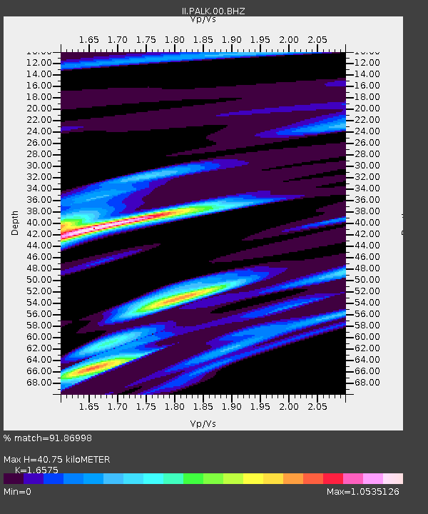
PALK Pallekele, Sri Lanka - Earthquake Result Viewer
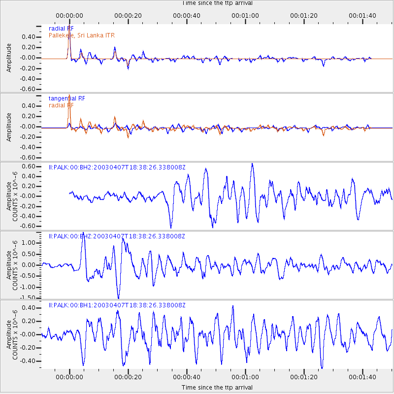
Earthquake location: Near East Coast Of Honshu, Japan
Earthquake latitude/longitude: 36.3/141.7
Earthquake time(UTC): 2003/04/07 (097) 18:28:37 GMT
Earthquake Depth: 33 km
Earthquake Magnitude: 5.5 MB, 5.5 MS, 5.9 MW, 5.8 MW
Earthquake Catalog/Contributor: WHDF/NEIC
Network: II Global Seismograph Network (GSN - IRIS/IDA)
Station: PALK Pallekele, Sri Lanka
Lat/Lon: 7.27 N/80.70 E
Elevation: 460 m
Distance: 62.4 deg
Az: 258.146 deg
Baz: 52.841 deg
Ray Param: 0.060181126
Estimated Moho Depth: 40.75 km
Estimated Crust Vp/Vs: 1.66
Assumed Crust Vp: 6.545 km/s
Estimated Crust Vs: 3.949 km/s
Estimated Crust Poisson's Ratio: 0.21
Radial Match: 91.86998 %
Radial Bump: 293
Transverse Match: 82.626205 %
Transverse Bump: 400
SOD ConfigId: 590571
Insert Time: 2013-09-25 01:43:28.202 +0000
GWidth: 2.5
Max Bumps: 400
Tol: 0.001

Signal To Noise

ChannelStoNSTALTA
II:PALK:00:BHZ:20030407T18:38:26.338008Z5.23985055.1830875E-79.891671E-8
II:PALK:00:BH1:20030407T18:38:26.338008Z3.0027791.5949314E-75.3115173E-8
II:PALK:00:BH2:20030407T18:38:26.338008Z4.21979332.2166489E-75.2529796E-8
Arrivals
Ps4.3 SECOND
PpPs16 SECOND
PsPs/PpSs20 SECOND