You are here: Home > Network List > TA - USArray Transportable Network (new EarthScope stations) Stations List
> Station O48A Farmland, IN, USA > Earthquake Result Viewer
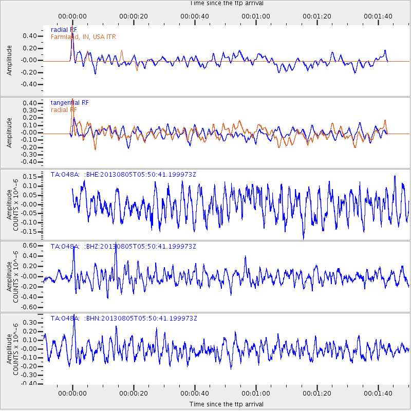
O48A Farmland, IN, USA - Earthquake Result Viewer
*The percent match for this event was below the threshold and hence no stack was calculated.
| Earthquake location: |
Near Coast Of Northern Chile |
| Earthquake latitude/longitude: |
-20.2/-70.7 |
| Earthquake time(UTC): |
2013/08/05 (217) 05:40:56 GMT |
| Earthquake Depth: |
19 km |
| Earthquake Magnitude: |
5.5 MB |
| Earthquake Catalog/Contributor: |
NEIC PDE/NEIC PDE-W |
|
| Network: |
TA USArray Transportable Network (new EarthScope stations) |
| Station: |
O48A Farmland, IN, USA |
| Lat/Lon: |
40.26 N/85.16 W |
| Elevation: |
300 m |
|
| Distance: |
61.6 deg |
| Az: |
347.469 deg |
| Baz: |
164.555 deg |
| Ray Param: |
$rayparam |
*The percent match for this event was below the threshold and hence was not used in the summary stack. |
|
| Radial Match: |
54.673084 % |
| Radial Bump: |
400 |
| Transverse Match: |
59.229294 % |
| Transverse Bump: |
400 |
| SOD ConfigId: |
589702 |
| Insert Time: |
2013-09-25 01:44:51.722 +0000 |
| GWidth: |
2.5 |
| Max Bumps: |
400 |
| Tol: |
0.001 |
|
Signal To Noise
| Channel | StoN | STA | LTA |
| TA:O48A: :BHZ:20130805T05:50:41.199973Z | 2.819511 | 1.9647314E-7 | 6.968341E-8 |
| TA:O48A: :BHN:20130805T05:50:41.199973Z | 1.4729354 | 1.4318151E-7 | 9.720827E-8 |
| TA:O48A: :BHE:20130805T05:50:41.199973Z | 1.1658002 | 5.9474747E-8 | 5.1016244E-8 |
| Arrivals |
| Ps | |
| PpPs | |
| PsPs/PpSs | |


