You are here: Home > Network List > IU - Global Seismograph Network (GSN - IRIS/USGS) Stations List
> Station RSSD Black Hills, South Dakota, USA > Earthquake Result Viewer
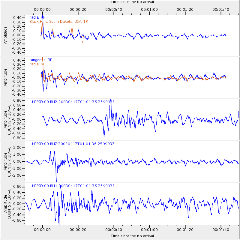
RSSD Black Hills, South Dakota, USA - Earthquake Result Viewer
*The percent match for this event was below the threshold and hence no stack was calculated.
| Earthquake location: |
Qinghai, China |
| Earthquake latitude/longitude: |
37.5/96.5 |
| Earthquake time(UTC): |
2003/04/17 (107) 00:48:38 GMT |
| Earthquake Depth: |
14 km |
| Earthquake Magnitude: |
6.2 MB, 6.3 MS, 6.4 MW, 6.2 MW |
| Earthquake Catalog/Contributor: |
WHDF/NEIC |
|
| Network: |
IU Global Seismograph Network (GSN - IRIS/USGS) |
| Station: |
RSSD Black Hills, South Dakota, USA |
| Lat/Lon: |
44.12 N/104.04 W |
| Elevation: |
2060 m |
|
| Distance: |
96.6 deg |
| Az: |
14.718 deg |
| Baz: |
343.713 deg |
| Ray Param: |
$rayparam |
*The percent match for this event was below the threshold and hence was not used in the summary stack. |
|
| Radial Match: |
74.78502 % |
| Radial Bump: |
315 |
| Transverse Match: |
83.278244 % |
| Transverse Bump: |
400 |
| SOD ConfigId: |
590571 |
| Insert Time: |
2013-09-25 01:47:03.434 +0000 |
| GWidth: |
2.5 |
| Max Bumps: |
400 |
| Tol: |
0.001 |
|
Signal To Noise
| Channel | StoN | STA | LTA |
| IU:RSSD:00:BHZ:20030417T01:01:36.259993Z | 4.6759996 | 4.805767E-7 | 1.0277518E-7 |
| IU:RSSD:00:BH1:20030417T01:01:36.259993Z | 1.5708061 | 1.1536306E-7 | 7.3441946E-8 |
| IU:RSSD:00:BH2:20030417T01:01:36.259993Z | 2.093765 | 2.2190466E-7 | 1.0598355E-7 |
| Arrivals |
| Ps | |
| PpPs | |
| PsPs/PpSs | |


