You are here: Home > Network List > IU - Global Seismograph Network (GSN - IRIS/USGS) Stations List
> Station RSSD Black Hills, South Dakota, USA > Earthquake Result Viewer
RSSD Black Hills, South Dakota, USA - Earthquake Result Viewer
*The percent match for this event was below the threshold and hence no stack was calculated.
| Earthquake location: |
Tonga Islands |
| Earthquake latitude/longitude: |
-15.1/-173.8 |
| Earthquake time(UTC): |
2003/04/22 (112) 16:39:44 GMT |
| Earthquake Depth: |
44 km |
| Earthquake Magnitude: |
5.6 MW |
| Earthquake Catalog/Contributor: |
NEIC PDE/NEIC PDE-M |
|
| Network: |
IU Global Seismograph Network (GSN - IRIS/USGS) |
| Station: |
RSSD Black Hills, South Dakota, USA |
| Lat/Lon: |
44.12 N/104.04 W |
| Elevation: |
2060 m |
|
| Distance: |
86.5 deg |
| Az: |
42.607 deg |
| Baz: |
245.199 deg |
| Ray Param: |
$rayparam |
*The percent match for this event was below the threshold and hence was not used in the summary stack. |
|
| Radial Match: |
80.063835 % |
| Radial Bump: |
400 |
| Transverse Match: |
73.96552 % |
| Transverse Bump: |
400 |
| SOD ConfigId: |
590571 |
| Insert Time: |
2013-09-25 01:48:56.700 +0000 |
| GWidth: |
2.5 |
| Max Bumps: |
400 |
| Tol: |
0.001 |
|
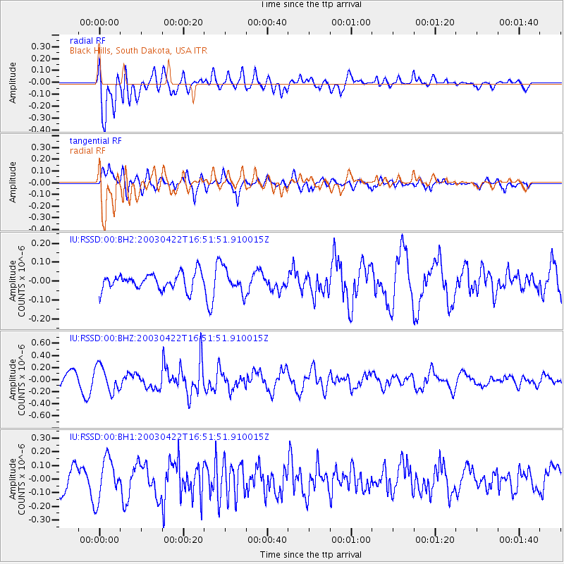
Signal To Noise
| Channel | StoN | STA | LTA |
| IU:RSSD:00:BHZ:20030422T16:51:51.910015Z | 1.5778071 | 2.13081E-7 | 1.3504884E-7 |
| IU:RSSD:00:BH1:20030422T16:51:51.910015Z | 1.5688258 | 1.4688288E-7 | 9.3626E-8 |
| IU:RSSD:00:BH2:20030422T16:51:51.910015Z | 1.4574599 | 6.156172E-8 | 4.223905E-8 |
| Arrivals |
| Ps | |
| PpPs | |
| PsPs/PpSs | |


