You are here: Home > Network List > IU - Global Seismograph Network (GSN - IRIS/USGS) Stations List
> Station JOHN Johnston Island, USA > Earthquake Result Viewer
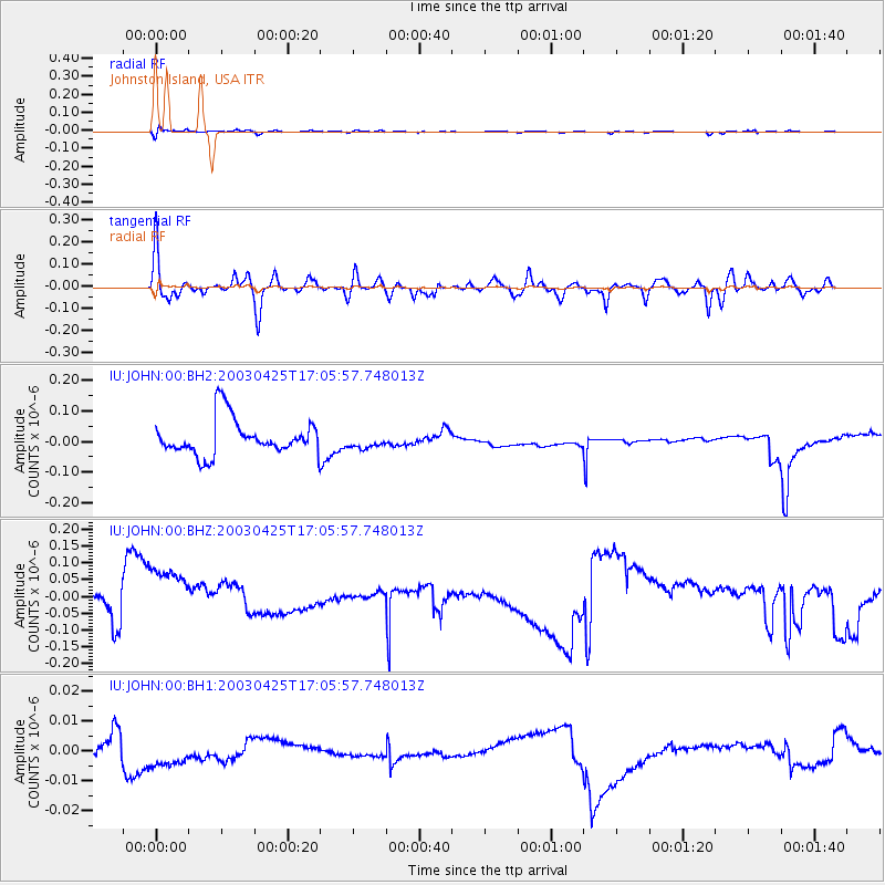
JOHN Johnston Island, USA - Earthquake Result Viewer
*The percent match for this event was below the threshold and hence no stack was calculated.
| Earthquake location: |
Irian Jaya Region, Indonesia |
| Earthquake latitude/longitude: |
-4.1/135.3 |
| Earthquake time(UTC): |
2003/04/25 (115) 16:56:36 GMT |
| Earthquake Depth: |
33 km |
| Earthquake Magnitude: |
5.6 MW, 5.6 MW |
| Earthquake Catalog/Contributor: |
NEIC PDE/NEIC PDE-M |
|
| Network: |
IU Global Seismograph Network (GSN - IRIS/USGS) |
| Station: |
JOHN Johnston Island, USA |
| Lat/Lon: |
16.73 N/169.53 W |
| Elevation: |
2.0 m |
|
| Distance: |
58.3 deg |
| Az: |
67.617 deg |
| Baz: |
254.283 deg |
| Ray Param: |
$rayparam |
*The percent match for this event was below the threshold and hence was not used in the summary stack. |
|
| Radial Match: |
42.20421 % |
| Radial Bump: |
400 |
| Transverse Match: |
45.844784 % |
| Transverse Bump: |
400 |
| SOD ConfigId: |
590571 |
| Insert Time: |
2013-09-25 01:50:19.483 +0000 |
| GWidth: |
2.5 |
| Max Bumps: |
400 |
| Tol: |
0.001 |
|
Signal To Noise
| Channel | StoN | STA | LTA |
| IU:JOHN:00:BHZ:20030425T17:05:57.748013Z | 0.9482531 | 1.2638404E-7 | 1.3328092E-7 |
| IU:JOHN:00:BH1:20030425T17:05:57.748013Z | 0.7661479 | 4.8980935E-9 | 6.3931433E-9 |
| IU:JOHN:00:BH2:20030425T17:05:57.748013Z | 0.4377606 | 2.5811838E-8 | 5.8963366E-8 |
| Arrivals |
| Ps | |
| PpPs | |
| PsPs/PpSs | |


