You are here: Home > Network List > IU - Global Seismograph Network (GSN - IRIS/USGS) Stations List
> Station POHA Pohakuloa, Hawaii, USA > Earthquake Result Viewer
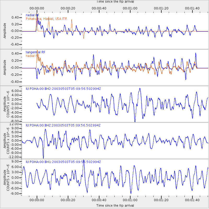
POHA Pohakuloa, Hawaii, USA - Earthquake Result Viewer
*The percent match for this event was below the threshold and hence no stack was calculated.
| Earthquake location: |
Tonga Islands |
| Earthquake latitude/longitude: |
-15.1/-173.7 |
| Earthquake time(UTC): |
2003/05/03 (123) 05:03:03 GMT |
| Earthquake Depth: |
33 km |
| Earthquake Magnitude: |
6.3 MB, 6.1 MS, 6.2 MW, 6.1 MW |
| Earthquake Catalog/Contributor: |
WHDF/NEIC |
|
| Network: |
IU Global Seismograph Network (GSN - IRIS/USGS) |
| Station: |
POHA Pohakuloa, Hawaii, USA |
| Lat/Lon: |
19.76 N/155.53 W |
| Elevation: |
1967 m |
|
| Distance: |
39.0 deg |
| Az: |
27.868 deg |
| Baz: |
208.639 deg |
| Ray Param: |
$rayparam |
*The percent match for this event was below the threshold and hence was not used in the summary stack. |
|
| Radial Match: |
60.607433 % |
| Radial Bump: |
400 |
| Transverse Match: |
57.953804 % |
| Transverse Bump: |
400 |
| SOD ConfigId: |
590571 |
| Insert Time: |
2013-09-25 01:54:25.250 +0000 |
| GWidth: |
2.5 |
| Max Bumps: |
400 |
| Tol: |
0.001 |
|
Signal To Noise
| Channel | StoN | STA | LTA |
| IU:POHA:00:BHZ:20030503T05:09:56.502994Z | 1.9018091 | 4.304093E-6 | 2.2631573E-6 |
| IU:POHA:00:BH1:20030503T05:09:56.502994Z | 1.0840687 | 2.7044966E-6 | 2.494765E-6 |
| IU:POHA:00:BH2:20030503T05:09:56.502994Z | 0.549966 | 1.2938722E-6 | 2.3526402E-6 |
| Arrivals |
| Ps | |
| PpPs | |
| PsPs/PpSs | |


