You are here: Home > Network List > IU - Global Seismograph Network (GSN - IRIS/USGS) Stations List
> Station JOHN Johnston Island, USA > Earthquake Result Viewer
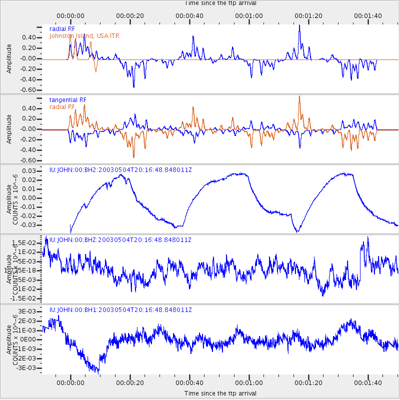
JOHN Johnston Island, USA - Earthquake Result Viewer
*The percent match for this event was below the threshold and hence no stack was calculated.
| Earthquake location: |
Kermadec Islands, New Zealand |
| Earthquake latitude/longitude: |
-30.6/-178.3 |
| Earthquake time(UTC): |
2003/05/04 (124) 20:08:46 GMT |
| Earthquake Depth: |
46 km |
| Earthquake Magnitude: |
6.0 MB, 6.1 MS, 6.4 MW, 6.4 MW |
| Earthquake Catalog/Contributor: |
WHDF/NEIC |
|
| Network: |
IU Global Seismograph Network (GSN - IRIS/USGS) |
| Station: |
JOHN Johnston Island, USA |
| Lat/Lon: |
16.73 N/169.53 W |
| Elevation: |
2.0 m |
|
| Distance: |
47.8 deg |
| Az: |
11.363 deg |
| Baz: |
190.213 deg |
| Ray Param: |
$rayparam |
*The percent match for this event was below the threshold and hence was not used in the summary stack. |
|
| Radial Match: |
81.92154 % |
| Radial Bump: |
248 |
| Transverse Match: |
83.2908 % |
| Transverse Bump: |
289 |
| SOD ConfigId: |
590571 |
| Insert Time: |
2013-09-25 01:56:39.154 +0000 |
| GWidth: |
2.5 |
| Max Bumps: |
400 |
| Tol: |
0.001 |
|
Signal To Noise
| Channel | StoN | STA | LTA |
| IU:JOHN:00:BHZ:20030504T20:16:48.848011Z | 0.7375125 | 7.1354953E-9 | 9.675084E-9 |
| IU:JOHN:00:BH1:20030504T20:16:48.848011Z | 1.2586931 | 2.5362283E-9 | 2.0149695E-9 |
| IU:JOHN:00:BH2:20030504T20:16:48.848011Z | 1.8613096 | 3.0211833E-8 | 1.6231493E-8 |
| Arrivals |
| Ps | |
| PpPs | |
| PsPs/PpSs | |


