You are here: Home > Network List > CI - Caltech Regional Seismic Network Stations List
> Station LRL Laurel Mtn Radio Fac, Ridgecrest, CA, USA > Earthquake Result Viewer
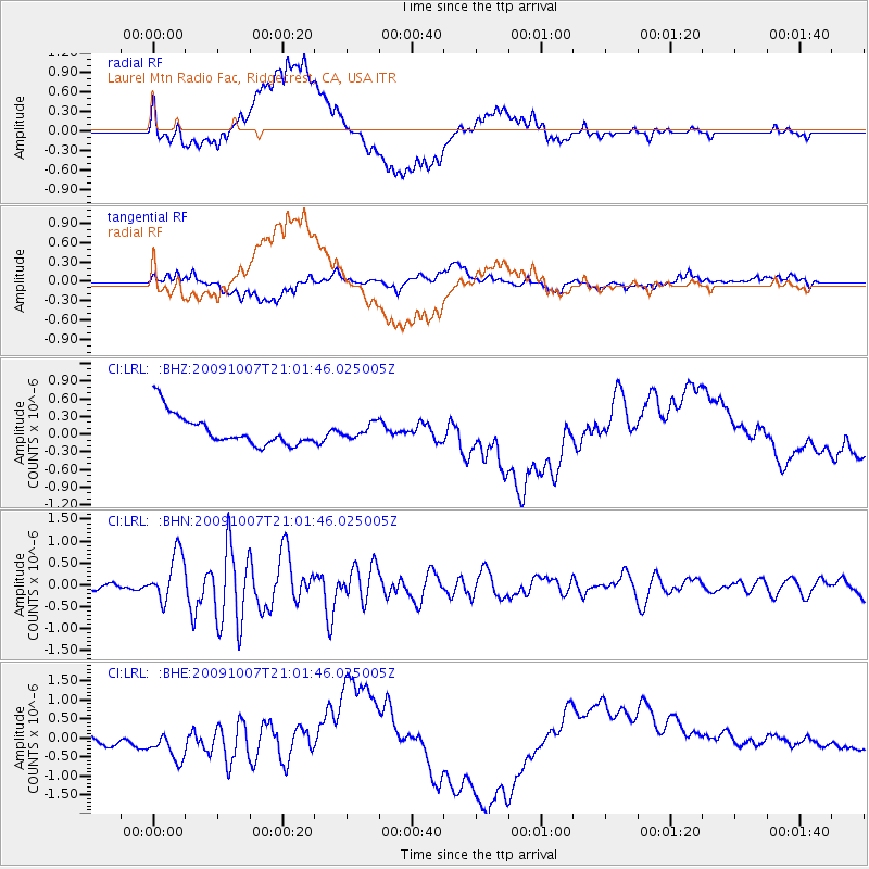
LRL Laurel Mtn Radio Fac, Ridgecrest, CA, USA - Earthquake Result Viewer
*The percent match for this event was below the threshold and hence no stack was calculated.
| Earthquake location: |
East Of Severnaya Zemlya |
| Earthquake latitude/longitude: |
81.6/119.5 |
| Earthquake time(UTC): |
2009/10/07 (280) 20:52:13 GMT |
| Earthquake Depth: |
8.0 km |
| Earthquake Magnitude: |
5.7 MB, 5.1 MS, 5.8 MW, 5.8 MW |
| Earthquake Catalog/Contributor: |
WHDF/NEIC |
|
| Network: |
CI Caltech Regional Seismic Network |
| Station: |
LRL Laurel Mtn Radio Fac, Ridgecrest, CA, USA |
| Lat/Lon: |
35.48 N/117.68 W |
| Elevation: |
1340 m |
|
| Distance: |
59.6 deg |
| Az: |
52.719 deg |
| Baz: |
351.73 deg |
| Ray Param: |
$rayparam |
*The percent match for this event was below the threshold and hence was not used in the summary stack. |
|
| Radial Match: |
34.21436 % |
| Radial Bump: |
400 |
| Transverse Match: |
27.705437 % |
| Transverse Bump: |
400 |
| SOD ConfigId: |
2622 |
| Insert Time: |
2010-02-25 20:43:37.511 +0000 |
| GWidth: |
2.5 |
| Max Bumps: |
400 |
| Tol: |
0.001 |
|
Signal To Noise
| Channel | StoN | STA | LTA |
| CI:LRL: :BHN:20091007T21:01:46.025005Z | 8.244417 | 5.508739E-7 | 6.681781E-8 |
| CI:LRL: :BHE:20091007T21:01:46.025005Z | 1.3921456 | 5.567922E-7 | 3.999526E-7 |
| CI:LRL: :BHZ:20091007T21:01:46.025005Z | 0.4293112 | 1.1383633E-7 | 2.6516042E-7 |
| Arrivals |
| Ps | |
| PpPs | |
| PsPs/PpSs | |


